Things To Do near Lints Tor

South Teign River, Chagford, Dartmoor National Park (approx. 6 miles away)
The River Teign is one of Dartmoor National Park's most beautiful waterways. It skirts Chagford and flows through the stunning Teign Gorge (National Trust) to the Teign Valley. Study the the Harvey British Mountain Map 'Dartmoor' map and you'll see that the River Teign rises at two places on Dart...
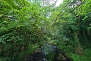
River Walkham, Dartmoor, Dartmoor National Park (approx. 6 miles away)
[Main photo: the River Walkham at Ward Bridge in the Walkham Valley] From high moor to the western border of Dartmoor National Park The River Walkham flows from remote, tussocky and boggy moorland on Dartmoor’s north moor through a heavily wooded valley to the western border of Dar...

River Cowsic, Princetown, Dartmoor National Park (approx. 6 miles away)
Fur Tor is said to be the most remote spot in southern England. Scattered across the edge of a high moorland plateau in the northern section of Dartmoor National Park, the rocky outcrops that form Fur Tor are close to the source of many famous Westcountry rivers. The West Dart River rises south east...

Church House, South Tawton, Dartmoor National Park (approx. 6 miles away)
In the middle of Dartmoor's most famous village, next to the 'Cathedral of the Moor', is the National Trust's Sextons Cottage and Church House. It's a beautiful and popular building. Up by the northern border of the National Park is the even more impressive South Tawton Church House. Ac...

Seven Stars Inn, South Tawton, Dartmoor National Park (approx. 6 miles away)
There's a cluster of pretty villages up by the northern border of Dartmoor National Park. South Tawton is one of them. At the heart of the village, across the square from South Tawton St Andrew's Church and the magnificent Church House, is the Seven Stars Inn. 'Holiday in Dartmoor' helps visitors...

South Tawton St Andrew's Church, South Tawton, Dartmoor National Park (approx. 6 miles away)
Drive the A30 across the top of Dartmoor from Devon towards Cornwall and you'll see a tall, beautiful church tower against the backdrop of the vast Cosdon Hill. This is South Tawton St Andrew's Church. We've positioned the church on Google maps so zoom in on the 'Satellite' setting to see...

Dartmoor Live Firing, Dartmoor, Dartmoor National Park (approx. 6 miles away)
If you see one of these flags then the army are using the area for live firing. You'll hear the gunfire well before you see red flags but, still, do look out for them. They're positioned on the highest ground so you can't miss them. Dartmoor has three army ranges: Okehampton, Wilsworthy and Merri...

White Tor, Langstone Moor and Great Staple Tor Circular Walk, Peter Tavy, Dartmoor National Park (approx. 6 miles away)
Impressive walk to the west of the Park incorporating one of Dartmoor's most dramatic tors. Use the Ordnance Survey OL28 Dartmoor map to help plan your walk in tandem with our Google maps and photographs. Start at the car park on the edge of Smeardon Down to the east of Peter Tavy. Follow the...

Longaford Tor, Two Bridges, Dartmoor National Park (approx. 6 miles away)
Longaford Tor is a big, impressive rocky outcrop that rises above Wistman's Wood National Nature Reserve on the edge of Dartmoor National Park's high north plateau. The views from Longaford Tor are spectacular so, given that the tor is very easily accessible, we'd very much recommend visiting. The t...

Leigh Bridge Stepping Stones/Milfordleigh Wood Stepping Stones, Chagford, Dartmoor National Park (approx. 6 miles away)
There are various clapper bridges and sets of stepping stones you can use to cross the North Teign River, South Teign River and the upper section of the River Teign after its two tributaries converge. At Leigh, on the North Teign River just before it meets the South Teign River, is a set of stone...

Milfordleigh Wood (National Trust), Chagford, Dartmoor National Park (approx. 6 miles away)
Dartmoor is home to some of the National Trust's best Westcountry properties such as Castle Drogo and Lydford Gorge. Collectively, these properties pull in huge numbers of visitors. However, there are also smaller National Trust properties and chunks of land that are less well visited. To our knowle...

Stephen's Grave, Peter Tavy, Dartmoor National Park (approx. 6 miles away)
In his 'Guide to Dartmoor', William Crossing wrote: 'Retracing our steps northward to the peat track (T.16), we turn L., shortly afterwards reaching a mound close beside it. This is known as Stephens' Grave [sic], and marks the site where a suicide was buried with the barbarous rites once customa...

Beardown Tors, Two Bridges, Dartmoor National Park (approx. 6 miles away)
Cluster of outcrops overlooking the West Dart River and Wistman's Wood National Nature Reserve Many of Dartmoor's most beautiful locations are shaped by rivers. The Dart Gorge, Teign Gorge, Tavy Cleave and Lustleigh Cleave are all cut by rivers flowing from the high moor. The river valley just no...

West Dart River, Dartmoor, Dartmoor National Park (approx. 6 miles away)
Dartmouth is one of the UK's most beautiful towns. Strung out along a steep-sided bank of the Dart Estuary where the river meets the South Devon coast, the town is packed with domestic and international tourists. Follow the river up to its two sources at the West Dart Head and East Dart Head on...

Holming Beam Bridge, Princetown, Dartmoor National Park (approx. 7 miles away)
There's a car parking area at Holming Beam offering access to the Merrivale Range area of Dartmoor National Park. This is a British Army firing range but it's open to the public for large chunks of the year. The car parking area is above a beautiful valley cut by the River Cowsic as it fl...