Things To Do near Hollow Tor

Lydford Gorge Circular Walk, Lydford, Dartmoor National Park (approx. 7 miles away)
Walking in a beautiful National Trust property on the western border of Dartmoor National Park When we first moved to Dartmoor in 2008, we were told repeatedly that the national park was bleak and wet. Whilst sections of the high moor on both the north and south plateaus can be challenging l...

Marker Stone, South Brent, Dartmoor National Park (approx. 7 miles away)
The Marker Stone is visible on the Ordnance Survey Explorer OL28 'Dartmoor' map where the Two Moors Way meets the Abbot's Way near Red Lake China Clay Works on Dartmoor's south moor. It's very useful if you're following the Abbot's Way west and need to descend to Red Lake Ford. See our Photo Gallery...

Snowdon, Holne, Dartmoor National Park (approx. 7 miles away)
Unlike its illustrious namesake in Snowdonia National Park, Snowdon is rather understated. And whilst the highest mountain in Wales and England is heaving with visitors in tourist seasons, you'll usually have Dartmoor's Snowdon to yourself. Situated near the highest point on Dartmoor's south moor, S...

Brentor, North Brentor, Dartmoor National Park (approx. 7 miles away)
Brentor is one of Dartmoor National Park's many attractions and we'll be adding more information shortly.

Brentor St Michael de Rupe Church, North Brentor, Dartmoor National Park (approx. 7 miles away)
Brentor St Michael de Rupe Church is one of Dartmoor National Park's many attractions and we'll be adding more information shortly.

Luckey Tor, Dartmeet, Dartmoor National Park (approx. 7 miles away)
If possible, buy a copy of Harvey's British Mountain Map 'Dartmoor' map. It was edited by the Dartmoor expert Eric Hemery and includes tracks and paths that aren't marked on the more popular and well-known Ordnance Survey Explorer OL28 'Dartmoor' map. A couple of these tracks and paths lead to a sup...

Rattle Brook, Lydford, Dartmoor National Park (approx. 7 miles away)
Rattle Brook rises by the Rattlebrook Peatworks (Disused) on remote moorland in the western section of Dartmoor National Park. It flows past Bleak House with Green Tor to the east and Higher and Lower Dunna Goat Tors to the west. Beyond Rattlebrook Mine (Disused), it runs between Amicombe Hill...

Erme Pound/Hook Lake Stone Row, South Brent, Dartmoor National Park (approx. 7 miles away)
Erme Pound/Hook Lake Stone Row is a short stone row just south east of Erme Pound by Hook Lake. If it weren't marked on the Ordnance Survey Explorer OL28 'Dartmoor' map, it would be difficult to find when exploring the area. The stones are small and obscured by long, moorland grass. We've po...

Sharp Tor (Dartmeet/East Dartmoor), Dartmoor, Dartmoor National Park (approx. 7 miles away)
Many of Dartmoor's classic views are provided by tors overlooking steep-sided wooded valleys and gorges. There's Sharp Tor in the Teign Gorge, Ger Tor above Tavy Cleave and the Dewerstone above the Dewerstone Valley. Perhaps the best of the lot is the view from Sharp Tor above Dart Gorge. If you can...
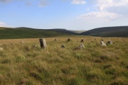
Stall Moor, Cornwood, Dartmoor National Park (approx. 7 miles away)
The River Erme and River Yealm rise on Dartmoor's south moor. They flow south to the border of the national park. Between them is Stall Moor. The terrain is difficult and boggy but the moor is peppered with amazing attractions from the world's longest stone row to a stunning waterfall. Stall Moor is...

Teignhead Farm (Ruins), Chagford, Dartmoor National Park (approx. 7 miles away)
Whilst chatting to a local farmer on Thornworthy Tor, we were told that two farms lay in ruins or were submerged by water in Fernworthy Forest and Fernworthy Reservoir. Another ruined farm lies just west of the forest near Sittaford Tor, Quintin's Man and the source of the North Teign River. This is...

Lydford Gorge (National Trust), Lydford, Dartmoor National Park (approx. 7 miles away)
[Main photo: view of the path running alongside the River Lyd in Lydford Gorge. Browse the images in the photo gallery to see Lydford Gorge through the seasons] The highest natural waterfall in South West England Lydford Gorge is a major visitor attraction in Dartmoor National Park....

The Dartmoor Inn, Lydford, Dartmoor National Park (approx. 7 miles away)
Superb location on the west side of Dartmoor The A386 runs down the west flank of Dartmoor National Park. The Dartmoor Inn is located on the side of the road by the major Dartmoor visitor destination Lydford and below some of Dartmoor's finest moorland. It's a perfect location from which to...

Cranmere Pool, Okehampton, Dartmoor National Park (approx. 7 miles away)
There are a number of attractions that every Dartmoor enthusiast wants to visit. High Willhays is Dartmoor's highest point. Fur Tor is the National Park's, and southern England's, most remote location. Bowerman's Nose is its most distinctive rocky outcrop. Cranmere Pool is the site of Dartmoor's fir...

West Okement Head, Okehampton, Dartmoor National Park (approx. 7 miles away)
Up on Dartmoor’s north plateau, within a short distance of each other, are the headwaters of many of the National Park’s most famous rivers. The moorland here is remote, boggy, rough cut and tussocky. Given that the headwaters are located on a plateau, it’s also possible to argue that the view...