Things To Do near Beechcroft Plantation

Swincombe Head, Princetown, Dartmoor National Park (approx. 5 miles away)
The River Swincombe rises above the infamous Foxtor Mires on the northern flank of Dartmoor National Park's south plateau. The River Avon rises to the east. The River Plym has its headwaters to the south west. We've positioned Swincombe Head on Google maps so zoom in on the 'Satellite' setting to...

River Yealm, Dartmoor, Dartmoor National Park (approx. 5 miles away)
There are a number of areas on Dartmoor's high north and south moors where many rivers, streams and brooks rise. The area around Cranmere Pool on the north moor is the most famous. On the south moor, the Langcombe Hill area is another. These areas are high, flat and very boggy. The River Yealm has i...
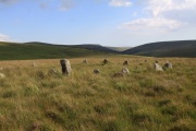
Stall Moor, Cornwood, Dartmoor National Park (approx. 5 miles away)
The River Erme and River Yealm rise on Dartmoor's south moor. They flow south to the border of the national park. Between them is Stall Moor. The terrain is difficult and boggy but the moor is peppered with amazing attractions from the world's longest stone row to a stunning waterfall. Stall Moor is...

Green Hill, South Brent, Dartmoor National Park (approx. 5 miles away)
The highest ground of Green Hill is at one end of the longest stone row in the world. If it weren't for this stone row, there would be very little reason to wander over its very shallow dome of moorland. The ground is boggy and tussocky and it's remote and surrounded by some tricky mires....

Little Mis Tor, Merrivale, Dartmoor National Park (approx. 5 miles away)
Many of Dartmoor's most impressive tors have much smaller satellite outcrops a bit like planets with their moons. Great Links Tor has Little Links Tor. Great Staple Tor has Middle Staple Tor and Little Staple Tor. The vast bulk of Great Mis Tor has Little Mis Tor. Situated just south of Great Mis...

Hawns and Dendles Gorge, Cornwood, Dartmoor National Park (approx. 5 miles away)
The River Yealm rises at Yealm Head on Dartmoor's south moor. It flows to Yealm Steps Waterfall where is cascades into Hawns and Dendles Gorge as marked on the Harvey British Mountain Map 'Dartmoor' map. Zoom in on the accompanying Google map to see its location.

Naker's Hill, Princetown, Dartmoor National Park (approx. 5 miles away)
On the ground, Naker's Hill feels how it looks in the main photo of this listing. Remote, featureless and boggy. This makes walking across the Naker's Hill section of Dartmoor strangely intimidating. That said, the North-South (Track) Ancient Travel Route, Black Lane Peat Pass an...

Cox, Roos and the Staple Tors Circular Walk, Tavistock, Dartmoor National Park (approx. 5 miles away)
Walking to one of Dartmoor's most impressive and photographed tors This walk takes you to Great Staple Tor which is one of Dartmoor National Park's most impressive and photographed tors. The walk also provides huge views over the Westcountry. The terrain is relatively easy and the walk...

Mount Misery Cross, Hexworthy, Dartmoor National Park (approx. 5 miles away)
Moorland climbs steeply south and east of Foxtor Mires. On the Ordnance Survey Explorer OL28 'Dartmoor' map, the land south of the mires is marked Crane Hill. The land to the east is Ter Hill. The Dartmoor expert Eric Hemery edited the Harvey British Mountain Map 'Dartmoor' map and used many loca...

Cox Tor, Merrivale, Dartmoor National Park (approx. 5 miles away)
Awesome views. Great place from which to watch the sun set over the Westcountry. Very easily accessible from a large car parking area on the western edge of Dartmoor's high moor. Cox Tor is also superb as part of a circular walk taking in Roos Tor and The Staple Tors. We've positioned Cox Tor on...

Swincombe Reservoir, Hexworthy, Dartmoor National Park (approx. 5 miles away)
Most Dartmoor reservoirs are large, impressive and reasonably easily accessible. Swincombe Reservoir is small and fenced off from the public. The moorland around the reservoir is flat, boggy and tussocky. Whilst there's a metal bridge at the eastern end of the reservoir, it's closed to the public so...

Roos Tor, Merrivale, Dartmoor National Park (approx. 5 miles away)
Roos is the northernmost tor in a cluster of outcrops on the western side of Dartmoor National Park. It's near the stunning and much photographed Great Staple Tor and overlooks Langstone Moor with its stone circle, standing stone and stone row. Great Mis Tor dominates to the east. The view north alo...

Double Waters, Yelverton, Dartmoor National Park (approx. 5 miles away)
The River Walkham meets the River Tavy at Double Waters on the western border of Dartmoor National Park. It's a beautiful place that's popular with wild swimmers and walkers. The long distance path the West Devon Way runs through here. We've positioned Double Waters on Google maps. Zoom in on the...

Tavistock to Ashburton Packhorse Track, Ashburton, Dartmoor National Park (approx. 5 miles away)
This ancient track is shown on the Harvey British Mountain Map 'Dartmoor' map. Unsurprisingly, it runs between Tavistock on the western border of the National Park to Ashburton on the eastern border. The central section of the track pretty much follows Conchies Road. We include Tavistock to Ash...

Erme Pound, South Brent, Dartmoor National Park (approx. 5 miles away)
A pound is an enclosure or space surrounded by a wall. The Erme is a river flowing from Dartmoor's south moor down to the South Devon coast. Erme Pound is an enclosure in the heart of Dartmoor's south moor reasonably close to the headwaters, or start, of the River Erme. In his book 'High Dartmoor...