Things To Do near Sheepstor Brook Ford and Scout Hut Copse

The Dewerstone Carrington Inscription, Shaugh Prior, Dartmoor National Park (approx. 3 miles away)
Nicholas Thomas Carrington, or Nicholas Toms Carrington, was a poet. Born in Plymouth in 1777, he is known for two long poems called 'The Banks of the Tamar' and 'Dartmoor'. His name and the date of his death are cut into a rock at the top of Dewerstone Hill above the Dewerstone Crags. As you can se...

Dewerstone Hill, Shaugh Prior, Dartmoor National Park (approx. 3 miles away)
Down by the south western border of Dartmoor National Park is a finger of moorland pushing out from Wigford Down. This is Dewerstone Hill. It's one of Dartmoor's most popular beauty spots offering stunning views over South Devon, Plymouth, the Tamar Valley Area of Outstanding Natural Beauty and...

South Hessary Tor, Princetown, Dartmoor National Park (approx. 3 miles away)
One of Dartmoor's most distinctive landmarks is the radio mast that rises north west of Princetown. North Hessary Tor and its trig point are situated next to the mast. At 517m above sea level and the highest point in the immediate vicinity of Princetown, North Hessary Tor provides big and impressive...

Ingra Tor, Princetown, Dartmoor National Park (approx. 3 miles away)
The Princetown Railway (Princetown to Yelverton Railway Dismantled) descends from Princetown to the border of Dartmoor National Park. All that remains is an old trackbed that's used for the Granite and Gears Princetown Railway Cycling Routes. The railway trackbed sweeps around a number of...

Dewerstone Crags, Shaugh Prior, Dartmoor National Park (approx. 3 miles away)
A local information board states that 'the popularity of climbing the Dewerstone Crags has resulted in considerable erosion of the fragile slopes from the crags to the main path ... The National Trust, Dartmoor National Park Authority and The British Mountaineering Council have worked together to re...

Princetown Railway (Princetown to Yelverton Railway Dismantled), Princetown, Dartmoor National Park (approx. 3 miles away)
Princetown Railway (Princetown to Yelverton Railway Dismantled) is one of Dartmoor National Park's many attractions and we'll be adding more information shortly.
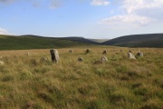
Stall Moor, Cornwood, Dartmoor National Park (approx. 3 miles away)
The River Erme and River Yealm rise on Dartmoor's south moor. They flow south to the border of the national park. Between them is Stall Moor. The terrain is difficult and boggy but the moor is peppered with amazing attractions from the world's longest stone row to a stunning waterfall. Stall Moor is...

River Yealm, Dartmoor, Dartmoor National Park (approx. 3 miles away)
There are a number of areas on Dartmoor's high north and south moors where many rivers, streams and brooks rise. The area around Cranmere Pool on the north moor is the most famous. On the south moor, the Langcombe Hill area is another. These areas are high, flat and very boggy. The River Yealm has i...

Childe's Tomb and Cross, Princetown, Dartmoor National Park (approx. 3 miles away)
Who was Childe? Whilst hunting on Dartmoor, Childe was overwhelmed by a snowstorm. To survive, he killed his horse, disembowelled it and then climbed inside for shelter. The snowstorm continued and Childe froze to death. Upon the event of his death, it became known that he'd leave his lands at Plyms...

Hawns and Dendles Gorge, Cornwood, Dartmoor National Park (approx. 4 miles away)
The River Yealm rises at Yealm Head on Dartmoor's south moor. It flows to Yealm Steps Waterfall where is cascades into Hawns and Dendles Gorge as marked on the Harvey British Mountain Map 'Dartmoor' map. Zoom in on the accompanying Google map to see its location.

Swincombe Headweir Ford, Princetown, Dartmoor National Park (approx. 4 miles away)
The River Swincombe and Strane River (having been fed by Nun's Cross Brook) meet at the eastern end of Foxtor Mires near the beginning of the old Wheal Emma Leat (Dry Channel). Just before they meet, there are two fords spanning each waterway. After a spell of dry weather, the ford across th...

Plym Valley (National Trust), Shaugh Prior, Dartmoor National Park (approx. 4 miles away)
If you look at the Ordnance Survey Landranger 191 'Okehampton and North Dartmoor' map, you'll see three blocks of moorland and wooded valley demarcated as National Trust land. This is what we refer to as Plym Valley (National Trust). Roughly speaking, and following the OS map, ...

Green Hill, South Brent, Dartmoor National Park (approx. 4 miles away)
The highest ground of Green Hill is at one end of the longest stone row in the world. If it weren't for this stone row, there would be very little reason to wander over its very shallow dome of moorland. The ground is boggy and tussocky and it's remote and surrounded by some tricky mires....

River Swincombe, Dartmoor, Dartmoor National Park (approx. 4 miles away)
By Dartmoor standards, this is a short river that rises on the edge of the National Park's south plateau and meets the West Dart River in Dartmoor's central bowl near Hexworthy. The river rises at Swincombe Head above what the Harvey British Mountain Map 'Dartmoor' map refers to as Suns...

Meavy Head, Princetown, Dartmoor National Park (approx. 4 miles away)
The River Meavy rises on the outskirts of Princetown by the old Princetown Railway (Princetown to Yelverton Railway Dismantled) below North Hessary Tor and Radio Mast. The B3212 Princetown to Yelverton road cuts across the headwaters at Devil's Bridge. Meavy Head is unusual for Dartmo...