Things To Do near West Dart Head

Trendlebere Down, Manaton, Dartmoor National Park (approx. 11 miles away)
In the eastern section of Dartmoor National Park, a road rises from the gateway town Bovey Tracey past the National Trust's Parke Estate to Yarner Wood and the East Dartmoor National Nature Reserve. The road bends sharply and car parking areas offer stunning views of the Bovey Valley, Lustle...

Great Trowlesworthy Tor, Shaugh Prior, Dartmoor National Park (approx. 11 miles away)
The Trowlesworthy Tors are situated close to the south western border of Dartmoor National Park. Little Trowlesworthy Tor sits below Great Trowlesworthy Tor between the River Plym/Cadover Bridge and the high south moor. The views from Great Trowlesworthy are superb. Moving clockwise, you'll see t...

River Dart Adventures, Ashburton, Dartmoor National Park (approx. 11 miles away)
Family attraction River Dart Adventures is an outdoor adventure park located within the River Dart Country Park on the outskirts of Ashburton near the eastern border of Dartmoor National Park. A family attraction, kids love it. As a day visitor, you pay to enter River Dart Country Park and the...

Stall Moor The Dancers Stone Circle, Cornwood, Dartmoor National Park (approx. 11 miles away)
Travel around the Westcountry and you'll come across plenty of stone circles named after dancers who were turned to stone. For example, the Nine Maidens Stone Circle is up on Dartmoor's north moor close to the village Belstone. Stall Moor The Dancers Stone Circle is on the south moor at the southern...

River Dart Country Park, Ashburton, Dartmoor National Park (approx. 11 miles away)
The River Dart Country Park is an area of woodland and parkland in the eastern section of Dartmoor National Park. The country park is named after the River Dart that flows through its grounds. This listing provides information on the country park from the perspective of a day visitor. Note that y...

Mardon Down Stone Circle, Moretonhampstead, Dartmoor National Park (approx. 11 miles away)
Prehistory/views Dartmoor's stone circles are invariably situated in stunning locations. Arguably, Mardon Down Stone Circle provides the finest views. Positioned on top of an island of moorland in the north eastern section of the National Park, there are massive views from the stone circle to Dar...

The Rock Inn, Haytor Vale, Dartmoor National Park (approx. 11 miles away)
Haytor Rocks beauty spot Haytor Rocks is Dartmoor's most popular tor. It's also the National Park's most popular beauty spot. Situated on the east flank of the moor, Haytor Rocks overlooks stunning South Devon countryside and coast. The Rock Inn is located in the village below this famous to...

Wray Cleave Bluebell Walk, Moretonhampstead, Dartmoor National Park (approx. 11 miles away)
Grab a copy of the Ordnance Survey Explorer OL28 'Dartmoor' map. Follow the Wray Valley south east of Moretonhampstead and you'll see Pepperdon Down above Steward Wood, Wray Barton and Wray Cleave. There's limited parking available at the top of Pepperdon Down along the side of the road. Start...

Wray Cleave, Moretonhampstead, Dartmoor National Park (approx. 11 miles away)
On Dartmoor, a cleave is usually taken to mean a wooded valley. Wray Cleave is a section of the Wray Valley between Moretonhampstead and Lustleigh in the north eastern section of the National Park. We include it on Holiday in Dartmoor because there's usually a good bluebell showing in Spring....

Trowlesworthy Settlements, Shaugh Prior, Dartmoor National Park (approx. 11 miles away)
The Upper Plym Valley in Dartmoor National Park is known for its concentration of Bronze Age and medieval sites. It was clearly an important and populated area. The high number of settlements are recorded on the Ordnance Survey Explorer OL28 'Dartmoor' map. There are some fine examples of settlement...

Cadover Bridge Cross, Shaugh Prior, Dartmoor National Park (approx. 11 miles away)
Cadover Bridge Cross, or Cadover Cross, is situated near Cadover Bridge that spans the River Plym at the mouth of the Dewerstone Valley near the south western border of Dartmoor National Park. We've positioned the cross on Google maps so zoom in on the 'Satellite' setting to see its location....

Heaven's Gate, Lustleigh, Dartmoor National Park (approx. 11 miles away)
There are plenty of 'gates' around Dartmoor that provide access to the National Park's high moorland and its river valleys. The appropriately named Heaven's Gate provides access to/from the stunning Bovey Valley and Lustleigh Cleave area from/to the pretty village Lustleigh. Heaven&#...
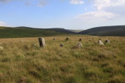
Stall Moor, Cornwood, Dartmoor National Park (approx. 11 miles away)
The River Erme and River Yealm rise on Dartmoor's south moor. They flow south to the border of the national park. Between them is Stall Moor. The terrain is difficult and boggy but the moor is peppered with amazing attractions from the world's longest stone row to a stunning waterfall. Stall Moor is...

Cadover Bridge, Shaugh Prior, Dartmoor National Park (approx. 11 miles away)
Cadover Bridge is a very popular visitor location near the south western border of Dartmoor National Park close to Plymouth and the South Devon coast. The local area is packed with things to do from walking to wild swimming, picnics to a pub lunch. We've positioned Cadover Bridge on Google m...

Bovey Valley, Bovey Tracey, Dartmoor National Park (approx. 11 miles away)
The River Bovey flows, roughly speaking, from the high moor north east of The Warren House Inn down to the River Teign near Stover Country Park. On Dartmoor, the Bovey Valley is usually taken to mean the beautiful wooded valley between Foxworthy Bridge and Drakeford Bridge. You could spend a holiday...