Things To Do near Higher Dunna Goat

Belstone Common, Belstone, Dartmoor National Park (approx. 5 miles away)
On the Ordnance Survey Explorer OL28 'Dartmoor' map, Belstone Common is marked as moorland between the River Taw and East Okement River covering Watchet Hill and Belstone Tors. 'Holiday in Dartmoor' is a practical guide to the National Park so our emphasis here is access points to the moor....

Adventure Okehampton, Okehampton, Dartmoor National Park (approx. 5 miles away)
As the name suggests, this is an adventure activity company based in Okehampton on the north west border of Dartmoor National Park. They provide an extraordinary range of activities taking advantage of their location below the only two mountains in southern England. Perfect for holiday adventure act...

Dartmoor Railway, Okehampton, Dartmoor National Park (approx. 5 miles away)
Dartmoor Railway at Okehampton Station in Okehampton Dartmoor Railway is based at Okehampton Station in Okehampton on the north west border of Dartmoor National Park. Once the railway station for Okehampton, today Dartmoor Railway specialises in leisure trips. Heritage trips and special events...

Stephen's Grave, Peter Tavy, Dartmoor National Park (approx. 5 miles away)
In his 'Guide to Dartmoor', William Crossing wrote: 'Retracing our steps northward to the peat track (T.16), we turn L., shortly afterwards reaching a mound close beside it. This is known as Stephens' Grave [sic], and marks the site where a suicide was buried with the barbarous rites once customa...

The Dartmoor Line and Okehampton Station, Okehampton, Dartmoor National Park (approx. 5 miles away)
[Main photo: West Mill Tor and Yes Tor from East Hill above Okehampton Station] Visitor hub for the north west section of Dartmoor National Park With the reopening of the Dartmoor Line (the initial train timetable states that 'there will be trains every two hours each way, seven days...

Belstone and West Cleave Circular Walk, Belstone, Dartmoor National Park (approx. 5 miles away)
Use the Ordnance Survey Explorer OL28 'Dartmoor' map in conjunction with our photographs and Google mapping. Start at the large car parking area on the northern side of Belstone village. Given the area's popularity, you're asked to park here as a visitor. Walk into the village and take the r...

Granite Way Cycles Hire, Okehampton, Dartmoor National Park (approx. 5 miles away)
The Granite Way is a popular multiuse trail on the north western fringe of Dartmoor National Park. You can horse ride, walk, run or cycle the route. If you fancy the latter but don't have a bike then you can hire one at either Devon Cycle Hire or Granite Way Cycles Hire. The latter is situated...

Brown's House (Ruin), Postbridge, Dartmoor National Park (approx. 5 miles away)
The West Dart River rises on Dartmoor National Park's high north plateau in boggy, rough cut moorland close to southern England's most remote spot at Fur Tor. The river builds strength as it flows south cutting moorland valleys on its way past Wistman's Wood National Nature Reserve to Tw...

Okehampton Camp to West Cleave Circular Walk, Okehampton, Dartmoor National Park (approx. 5 miles away)
West Cleave is a stunning place. Whilst you can walk in from all directions, our favourite approach is from the west. There are a number of circular walks you can complete from the Okehampton Camp area. Note that this is one of the best areas on Dartmoor for bluebells in Spring. From Okehampton,...

Three Stone Circles Circular Walk, Chagford, Dartmoor National Park (approx. 5 miles away)
The Three Stone Circles Circular Walk, or the Fernworthy Stone Circle, Sittaford Stone Circle and The Grey Wethers Stone Circles Circular Walk, takes you through Fernworthy Forest out onto Dartmoor's high north moor. It takes in three of the many stone circles and stone rows in this section of...

Watchet Hill, Belstone, Dartmoor National Park (approx. 5 miles away)
A high number of hills fringe Dartmoor's north moor. Cosdon Hill is the biggest. East Hill is the furthest north. Between them is the superbly located Watchet Hill by the village Belstone. If you're going to spend time exploring Dartmoor's high ground, it's likely you'll cross Watchet Hill at som...

The Grey Wethers Stone Circles, Postbridge, Dartmoor National Park (approx. 5 miles away)
Head west through the dense conifer plantations of Fernworthy Forest and you come to the edge of Dartmoor's high north plateau. In cold or dry months, long blond grass covers the moors. The giant granite blocks that form the two Grey Wethers Stone Circles jut out from this grass and shape a figure o...

East Okement Valley, Okehampton, Dartmoor National Park (approx. 5 miles away)
The East Okement River rises by the army ring road on Okement Hill high on Dartmoor's north plateau. It flows north over Deep Ford and Henry's Ford to the popular crossing point Cullever Steps. Beyond a wild swimming pool, below Scarey Tor, the river cuts the beautiful East Okement Valley that runs...

East Okement River, Okehampton, Dartmoor National Park (approx. 5 miles away)
Okehampton is one of Dartmoor's gateway towns. It sits beneath the highest ground in the National Park. As clouds are blown across Cornwall, they hit this high ground and dump rain on the moors. The rain collects in rivers and flows downhill back towards the coast. The River Okement is one such wate...
River Walkham, Dartmoor, Dartmoor National Park (approx. 5 miles away)
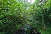
[Main photo: the River Walkham at Ward Bridge in the Walkham Valley] From high moor to the western border of Dartmoor National Park The River Walkham flows from remote, tussocky and boggy moorland on Dartmoor’s north moor through a heavily wooded valley to the western border of Dar...