Things To Do near Roos Tor

West Devon Way, Dartmoor, Dartmoor National Park (approx. 9 miles away)
One of the best ways to get to know the north west, west and south west of Dartmoor National Park is to walk the West Devon Way. At 37 miles, you'll either have to make a holiday of it or break the walk down into smaller chunks. The following describes the route running north to south from Okeham...

Sharp Tor (Dartmeet/East Dartmoor), Dartmoor, Dartmoor National Park (approx. 9 miles away)
Many of Dartmoor's classic views are provided by tors overlooking steep-sided wooded valleys and gorges. There's Sharp Tor in the Teign Gorge, Ger Tor above Tavy Cleave and the Dewerstone above the Dewerstone Valley. Perhaps the best of the lot is the view from Sharp Tor above Dart Gorge. If you can...

Penn Moor, Cornwood, Dartmoor National Park (approx. 9 miles away)
Penn Moor is situated at the southern egde of Dartmoor's south moor. It rises above Dendles Wood National Nature Reserve and China Clay Workings. It's topped by Penn Beacon.

The Devil's Playing Cards/The Ace Fields, Postbridge, Dartmoor National Park (approx. 9 miles away)
According to the Dartmoor expert William Crossing, 'Jan Reynolds once entered into a compact with a stranger, who turned out to be the Prince of Darkness, and failing to keep it became his victim. Seven years after the meeting Jan was discovered indulging in a nap in Widecombe Church on a Sunday...

Fernworthy Reservoir Potter's Walk, Chagford, Dartmoor National Park (approx. 9 miles away)
There's a large public car park by Fernworthy Reservoir at the entrance to Fernworthy Forest. Fernworthy Reservoir Potter's Walk starts, and ends, at the car park. A local information board we photographed back in January 2010 reads: 'Potter's Walk. Footpath suitable for disable...

Penn Beacon, Cornwood, Dartmoor National Park (approx. 9 miles away)
The Oxford English Dictionary defines a beacon as 'a fire or light set up in a high or prominent position as a warning, signal, or celebration’. There is a chain of beacons on Dartmoor running from the edge of the north moor down to the edge of the south moor. Penn Beacon is at the edge...

Fernworthy Hut Circles, Chagford, Dartmoor National Park (approx. 9 miles away)
Fernworthy Forest and the surrounding moorland are home to a high number of prehistoric sites. Highlights include Fernworthy Stone Circle and Hurston Ridge/Chagford Common Stone Row. The most common prehistoric sites you'll see are hut circles. There's a particularly good example just off...

Long Stone Standing Stone (Shovel Down), Chagford, Dartmoor National Park (approx. 9 miles away)
On the edge of Shovel Down by Chagford Common is a large standing stone known as the Long Stone. The Long Stone is part of the Shovel Down complex of prehistoric monuments and is at the southern end of the Shovel Down Stone Rows. Letters were subsequently carved into the stone for use as a boundary...

Thornworthy Tor, Chagford, Dartmoor National Park (approx. 9 miles away)
Explore the northern section of Chagford Common and, against the backdrop of Fernworthy Forest, you'll see a rocky outcrop topping a reasonably large hill surrounded by a chunky stone wall. The outcrop is Thornworthy Tor and we were told by the local farmer that the wall demarcates a newtake or Dart...

Thornworthy Down, Chagford, Dartmoor National Park (approx. 9 miles away)
On the fringe of the high moors in the north eastern section of Dartmoor National Park, Chagford Common curls around Fernworthy Forest and Fernworthy Reservoir. Towards the centre of the common, topped by a tor and logan stone, is Thornworthy Down. We'd recommend visiting for the views across the fo...

Luckey Tor, Dartmeet, Dartmoor National Park (approx. 9 miles away)
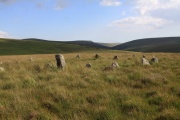
If possible, buy a copy of Harvey's British Mountain Map 'Dartmoor' map. It was edited by the Dartmoor expert Eric Hemery and includes tracks and paths that aren't marked on the more popular and well-known Ordnance Survey Explorer OL28 'Dartmoor' map. A couple of these tracks and paths lead to a sup...
Stall Moor, Cornwood, Dartmoor National Park (approx. 9 miles away)
The River Erme and River Yealm rise on Dartmoor's south moor. They flow south to the border of the national park. Between them is Stall Moor. The terrain is difficult and boggy but the moor is peppered with amazing attractions from the world's longest stone row to a stunning waterfall. Stall Moor is...

Yealm Steps, Cornwood, Dartmoor National Park (approx. 9 miles away)
Yealm Steps is one of Dartmoor National Park's many attractions and we'll be adding more information shortly.

Yealm Steps Waterfall, Cornwood, Dartmoor National Park (approx. 9 miles away)
A beautiful waterfall on remote, high moor roughly a kilometre south of Yealm Head, Yealm Steps Waterfall is in the upper section of Hawns and Dendles Gorge. The waterfall is reasonably close to Dendles Wood National Nature Reserve. Stall Moor, with its extraordinary stone rows, is to the east. The...

Birch Tor and Vitifer Tin Mine (Disused), Postbridge, Dartmoor National Park (approx. 9 miles away)
The moorland east of The Warren House Inn is heavily scarred by centuries of tin mining. It's topped by Birch Tor. Birch Tor and Vitifer Tin Mine is the name given to a group of mines worked in this area. When you visit, you'll walk in, by or above scooped up of the moorland by the tinners....