Things To Do near Plymouth

Harford Moor Gate, Harford, Dartmoor National Park (approx. 11 miles away)
Temporarily closed Harford Moor Gate car park is temporarily closed. A sign reads: 'Car park closed. This car park is on privately owned access land. It has been closed from February 2021. This has been done for two reasons. To help control footfall on this part of the moor. T...

Parking And Access To Dartmoor's South Moor, Harford, Dartmoor National Park (approx. 11 miles away)
Update 2021 Note that Harford Moor Gate car park is temporaily closed as of 2021. Click through to the listing to learn more. The easiest way to get to Harford Moor Gate and the south moor beyond is on foot. Start at Ivybridge and follow the Two Moors Way up onto the south moor. The Tw...

Drizzle Combe Settlements, Sheepstor, Dartmoor National Park (approx. 11 miles away)
Look at the Upper Plym Valley area (follow the River Plym upstream from Cadover Bridge to Plym Head) on the Ordnance Survey Explorer OL28 'Dartmoor' map and you'll see a high number of settlements. By Drizzle Combe, there are the remains of a large settlement at Whittenknowles Rocks a...

Burrator Arboretum and Nature Reserve, Yelverton, Dartmoor National Park (approx. 11 miles away)
An information board on site reads: 'The Burrator Arboretum was created following the storms in the late 1980s, as a collection of native and non native specimens. One of its primary functions is to provide easy access to reservoir visitors who may struggle to explore other areas of the site.'

Yealm Head, Cornwood, Dartmoor National Park (approx. 11 miles away)
The River Yealm rises, or begins, at Yealm Head. Yealm Head is situated on the southern side of a vast, flat and boggy stretch of moorland called Langcombe Hill. You don't find many people up there. If you have an urge to go, we'd recommend walking after a long period of dry weather or after extreme...

Ditsworthy Warren, Sheepstor, Dartmoor National Park (approx. 11 miles away)
Study a map of Dartmoor and you'll see plenty of names with the word 'warren' in them. Perhaps the most well-known example is Headland Warren by The Warren House Inn in the heart of the National Park. Another is Ditsworthy Warren in the Upper Plym Valley in the southern section of Dartmoor. Warre...

Drizzle Combe (Drizzlecombe), Sheepstor, Dartmoor National Park (approx. 11 miles away)
Drizzle Combe is a short valley in the southern section of the Dartmoor National Park. It's situated between Burrator Reservoir and the high south moor. Cut by a brook, the area is known for its prehistoric sites and is part of the Upper Plym Valley (English Heritage). In his book 'High Dartmoo...

Stalldown Stone Row, Cornwood, Dartmoor National Park (approx. 11 miles away)
Many people think this is the most impressive stone row in Dartmoor National Park. Its giant stones can be seen from miles around. If you didn't know they were there, from afar, you'd assume they were a long line of people wandering to or from the heart of Dartmoor's south moor. These days, the...

Cross Gate/Lowery Cross, Princetown, Dartmoor National Park (approx. 11 miles away)
This cross is situated by Cross Gate as marked on the Ordnance Survey Explorer OL28 'Dartmoor' map. It's also known locally as Lowery Cross. Zoom in on the 'Satellite' setting of the accompanying Google map to see its location. Cross Gate/Lowery Cross is on both the Buckfast to Tavistoc...

Burrator Plantations, Yelverton, Dartmoor National Park (approx. 11 miles away)
Explore the Burrator Reservoir area and at some point you'll be walking in one of the many plantations that fringe the reservoirs and extend up nearby valleys. Access/points of interest in these plantations are covered below. Peekhill Plantation. The Granite and Gears Princetown Ra...

Norsworthy Bridge, Yelverton, Dartmoor National Park (approx. 11 miles away)
We include Norsworthy Bridge as a point of reference. Located at the eastern end of Burrator Reservoir, there's a large car parking area by the bridge. It's on a ring road that runs around the water. Norsworthy Bridge is a great place from which to walk to Down Tor and Down Tor Stone Row (Hingsto...

Peek Hill, Yelverton, Dartmoor National Park (approx. 11 miles away)
Part of a circular walk that we recommend, the views from Peek Hill down to Burrator Reservoir and across to Sheeps Tor are exceptional. If you can make it on a sunny day in autumnal October then you're in for a treat.
Stall Moor, Cornwood, Dartmoor National Park (approx. 11 miles away)
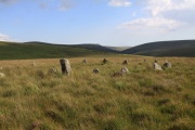
The River Erme and River Yealm rise on Dartmoor's south moor. They flow south to the border of the national park. Between them is Stall Moor. The terrain is difficult and boggy but the moor is peppered with amazing attractions from the world's longest stone row to a stunning waterfall. Stall Moor is...

Western Beacon, Harford, Dartmoor National Park (approx. 11 miles away)
Dartmoor National Park's most southerly beacon or tor. Great views down to Ivybridge and across South Devon. Plymouth's to the west. We'd recommend visiting as part of a walk from the moorland car park by Harford. From that car park, cut across the moors to Hangershell Rock and then head south to...

Langcombe Brook, Sheepstor, Dartmoor National Park (approx. 11 miles away)
Langcombe Hill is 474 metres above sea level on Dartmoor's south moor. It's a flat and boggy area of remote moorland. Langcombe Brook drops north west to Plym Steps on the River Plym. Langcombe Brook has its headwaters at Langcombe Head. Between Langcombe Head and Plym Steps are many points...