Things To Do near Plymouth

Skir Hill, Hexworthy, Dartmoor National Park (approx. 15 miles away)
Skir Hill is up there on the list of the most unlikely places you'll find yourself in Dartmoor National Park. Remote and with few obvious points of interest on it, Skir Hill also isn't on one of the many modern recreation paths or ancient travel routes that criss-cross the moor. If you're walking...

Little Mis Tor, Merrivale, Dartmoor National Park (approx. 15 miles away)
Many of Dartmoor's most impressive tors have much smaller satellite outcrops a bit like planets with their moons. Great Links Tor has Little Links Tor. Great Staple Tor has Middle Staple Tor and Little Staple Tor. The vast bulk of Great Mis Tor has Little Mis Tor. Situated just south of Great Mis...

Buckfastleigh Moor, Scorriton, Dartmoor National Park (approx. 15 miles away)
[Main photo: walking the Two Moors Way from Holne and Scorriton to Buckfastleigh Moor] Buckfastleigh Moor, the highest point on Dartmoor’s south moor and the Two Moors Way Ryder’s Hill is the highest point on Dartmoor’s south moor. Buckfastleigh Moor runs from this hi...

Tavistock to Ashburton Packhorse Track, Ashburton, Dartmoor National Park (approx. 15 miles away)
This ancient track is shown on the Harvey British Mountain Map 'Dartmoor' map. Unsurprisingly, it runs between Tavistock on the western border of the National Park to Ashburton on the eastern border. The central section of the track pretty much follows Conchies Road. We include Tavistock to Ash...

Great Mis Tor, Merrivale, Dartmoor National Park (approx. 15 miles away)
Great Mis Tor is one of the most easily accessible of the high, rocky tors on Dartmoor. Located on the western side of the National Park near Princetown, Great Mis Tor is part of a cluster of beautiful granite outcrops by the B3357 that runs between Princetown and Tavistock. The much photographed...

Swincombe, Hexworthy, Dartmoor National Park (approx. 15 miles away)
Swincombe is a collection of ruined, disused buildings just west of Hexworthy. It's named on the Harvey British Mountain Map 'Dartmoor' map. The buildings are drawn on an area of private land on the Ordnance Survey Explorer OL28 'Dartmoor' map but not named. Swincombe consists of Higher/Upper and...

Swincombe Bridge (Swincombe Fairy Bridge/Swincombe Ford Bridge), Hexworthy, Dartmoor National Park (approx. 15 miles away)
The River Swincombe rises on the edge of Dartmoor's south plateau. It flows into Foxtor Mires where it meets Strane River at Headweir Ford. From there, it picks up speed and tumbles through a very pretty valley to a reservoir. Downstream of the reservoir, by the ruined buildings at Swincombe, is the...

Down Ridge, Hexworthy, Dartmoor National Park (approx. 15 miles away)
Down Ridge provides great access to the crosses on the Buckfast to Tavistock Monastic Route up at Ter Hill and Mount Misery. From there, you can also drop down to Foxtor Farm and Childe's Tomb. We've positioned Down Ridge on Google maps so zoom in on the 'Satellite' setting to see its locati...

Stephen's Grave, Peter Tavy, Dartmoor National Park (approx. 15 miles away)
In his 'Guide to Dartmoor', William Crossing wrote: 'Retracing our steps northward to the peat track (T.16), we turn L., shortly afterwards reaching a mound close beside it. This is known as Stephens' Grave [sic], and marks the site where a suicide was buried with the barbarous rites once customa...

Skir Ford Cross, Hexworthy, Dartmoor National Park (approx. 15 miles away)
Skir Ford Cross is one of the many wonderful stone crosses waymarking the Buckfast to Tavistock Monastic Route across Dartmoor's National Park's south moor. The cross takes its name from nearby ford which is on the north side of Skir Hill. We've positioned Skir Ford Cross on Google maps...

White Tor, Langstone Moor and Great Staple Tor Circular Walk, Peter Tavy, Dartmoor National Park (approx. 16 miles away)
Impressive walk to the west of the Park incorporating one of Dartmoor's most dramatic tors. Use the Ordnance Survey OL28 Dartmoor map to help plan your walk in tandem with our Google maps and photographs. Start at the car park on the edge of Smeardon Down to the east of Peter Tavy. Follow the...
River Walkham, Dartmoor, Dartmoor National Park (approx. 16 miles away)
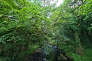
[Main photo: the River Walkham at Ward Bridge in the Walkham Valley] From high moor to the western border of Dartmoor National Park The River Walkham flows from remote, tussocky and boggy moorland on Dartmoor’s north moor through a heavily wooded valley to the western border of Dar...

Holne Moor, Holne, Dartmoor National Park (approx. 16 miles away)
Holne is a village on Dartmoor. Holne Moor is an area of moorland above the village on the National Park's south moor. It's very popular with walkers, fringes the amazing Dart Gorge and is packed with points of interest. We've positioned Holne Moor on Google maps. Zoom in on the 'Satellite' setti...

Langstone Moor and Langstone Mire, Peter Tavy, Dartmoor National Park (approx. 16 miles away)
On the western side of Dartmoor National Park, close to the B3357 as it climbs from Tavistock to Merrivale, is a cluster of well known tors. Cox Tor, the Staple Tors and Great Mis Tor attract large numbers of walkers. Just beyond these is Langstone Moor with its stone circle, standing stone, st...

Langstone Moor Stone Circle, Peter Tavy, Dartmoor National Park (approx. 16 miles away)
Dartmoor's stone circles tend to occupy stunning locations. Langstone Moor Stone Circle is no exception. Situated in a vast, open stretch of moorland with the bulk of Great Mis Tor rising to the south east, Langstone Moor Stone Circle is essential visiting if you're interested in Dartmoor's prehisto...