Things To Do near Tamar Trails Walking

East Dart River Waterfall, Postbridge, Dartmoor National Park (approx. 13 miles away)
With its rocky high ground and numerous rivers, Dartmoor National Park has many waterfalls. In Lydford Gorge (National Trust) and Canonteign Falls, water falls from a great height. In Becky Falls Woodland Park and Yealm Steps Waterfall, water tumbles dramatically over rocks. The waterfall on the upp...

River Yealm, Dartmoor, Dartmoor National Park (approx. 13 miles away)
There are a number of areas on Dartmoor's high north and south moors where many rivers, streams and brooks rise. The area around Cranmere Pool on the north moor is the most famous. On the south moor, the Langcombe Hill area is another. These areas are high, flat and very boggy. The River Yealm has i...

Ter Hill Cross (East), Hexworthy, Dartmoor National Park (approx. 13 miles away)
One of two crosses on Ter Hill on the edge of Dartmoor's south plateau. The cross is part of the Buckfast to Tavistock Monastic Route. See our Ter Hill Cross (West) listing for further information and directions.

Ter Hill, Hexworthy, Dartmoor National Park (approx. 13 miles away)
Roughly speaking, Dartmoor consists of two areas of high moorland divided by a central bowl. The south moor rises from hamlets and villages south of Hexworthy, Dartmeet and Holne towards a series of very shallow domed hills. Ter Hill is one of these shallow domed hills on the northern flank of the N...

Naker's Hill, Princetown, Dartmoor National Park (approx. 13 miles away)
On the ground, Naker's Hill feels how it looks in the main photo of this listing. Remote, featureless and boggy. This makes walking across the Naker's Hill section of Dartmoor strangely intimidating. That said, the North-South (Track) Ancient Travel Route, Black Lane Peat Pass an...

Hawns and Dendles Gorge, Cornwood, Dartmoor National Park (approx. 13 miles away)
The River Yealm rises at Yealm Head on Dartmoor's south moor. It flows to Yealm Steps Waterfall where is cascades into Hawns and Dendles Gorge as marked on the Harvey British Mountain Map 'Dartmoor' map. Zoom in on the accompanying Google map to see its location.

West Okement Head, Okehampton, Dartmoor National Park (approx. 13 miles away)
Up on Dartmoor’s north plateau, within a short distance of each other, are the headwaters of many of the National Park’s most famous rivers. The moorland here is remote, boggy, rough cut and tussocky. Given that the headwaters are located on a plateau, it’s also possible to argue that the view...

Cranmere Pool, Okehampton, Dartmoor National Park (approx. 13 miles away)
There are a number of attractions that every Dartmoor enthusiast wants to visit. High Willhays is Dartmoor's highest point. Fur Tor is the National Park's, and southern England's, most remote location. Bowerman's Nose is its most distinctive rocky outcrop. Cranmere Pool is the site of Dartmoor's fir...

Broad Down, Postbridge, Dartmoor National Park (approx. 13 miles away)
If you're heading to Fur Tor or Cut Hill from Postbridge, it's likely you'll be walking over, or around, Broad Down. It's a beautiful spot offering great views of the East Dart River. Broad Down forms part of a lovely circular walk from Postbridge to the East Dart River Waterfall and back again....

Green Hill, South Brent, Dartmoor National Park (approx. 14 miles away)
The highest ground of Green Hill is at one end of the longest stone row in the world. If it weren't for this stone row, there would be very little reason to wander over its very shallow dome of moorland. The ground is boggy and tussocky and it's remote and surrounded by some tricky mires....

Dinger Tor, Okehampton, Dartmoor National Park (approx. 14 miles away)
An army ring road pushes out from Okehampton Camp on Dartmoor's north moor. On the ground, this army ring road is in fact a network of roads and tracks that provide easy access to remote moorland. At the south western extent of this ring road is Dinger Tor. It's a small rocky outcrop overlooking a l...
Stall Moor, Cornwood, Dartmoor National Park (approx. 14 miles away)
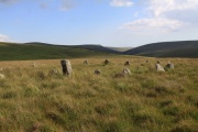
The River Erme and River Yealm rise on Dartmoor's south moor. They flow south to the border of the national park. Between them is Stall Moor. The terrain is difficult and boggy but the moor is peppered with amazing attractions from the world's longest stone row to a stunning waterfall. Stall Moor is...

East Dart Head, Belstone, Dartmoor National Park (approx. 14 miles away)
On Dartmoor's north plateau, in a bowl of moorland below some of the National Park's highest hills, are the headwaters of the East Dart River. It's a remote, strangely intoxicating area far away from villages and towns. After periods of wet weather, the land is boggy and unpleasant to walk across. I...

Homerton Hill, Okehampton, Dartmoor National Park (approx. 14 miles away)
Homerton is one of the hills surrounding Meldon Reservoir near the north western border of Dartmoor National Park. A popular path skirts the north and west sides of the hill around the reservoir and leads from the dam to Vellake Corner and then up to Black-a-Tor Copse National Nature Reserve. We'...

Battle of Sourton Down Battlefield, Sourton, Dartmoor National Park (approx. 14 miles away)
Sourton is a small village on the north eastern border of Dartmoor National Park. Sourton Down is a nearby area of countryside where the A30 passes over the A386. Dartmoor's highest ground at Yes Tor and High Willhays is visible from the down. On the night of the 25th April 1643, this was the locati...