Things To Do near Rattlebrook Peatworks Railway (Disused)

Best Belstone Walks, Belstone, Dartmoor National Park (approx. 6 miles away)
Belstone Belstone is one of the best places from which to walk in Dartmoor National Park. Located on the edge of Dartmoor's north moor, Belstone offers access to many of Dartmoor's most beautiful tors and hills. In addition, you can walk several stunning wooded valleys and explore some top prehis...

Stephen's Grave, Peter Tavy, Dartmoor National Park (approx. 6 miles away)
In his 'Guide to Dartmoor', William Crossing wrote: 'Retracing our steps northward to the peat track (T.16), we turn L., shortly afterwards reaching a mound close beside it. This is known as Stephens' Grave [sic], and marks the site where a suicide was buried with the barbarous rites once customa...

River Taw, Belstone, Dartmoor National Park (approx. 6 miles away)
For anyone who loves the poetry of Ted Hughes, the River Taw should be a very special place. Near Taw Head, where the river rises, is a simple granite memorial stone to the Poet Laureate. Sunk into a mound on the west bank of the river, a visit to the memorial stone on a walk from Belstone is a grea...

Raybarrow Pool, Throwleigh, Dartmoor National Park (approx. 6 miles away)
Avoid. Dartmoor's a great National Park for young kids. Its highest ground is easily accessible and its landscape provides few real problems if you're properly prepared. There are, however, a few places that are genuinely dangerous. We'd place Raybarrow Pool at the top of the list. We've posit...

Cosdon Hill (Cawsand Hill), Belstone, Dartmoor National Park (approx. 6 miles away)
Cosdon Hill, or Cawsand Hill, is one of the most recognisable natural features in Dartmoor. Its huge, shallow dome dominates the northern border of the National Park and is visible from miles around. You'll see Cosdon from the Haytor Rocks area in the eastern section of the Park and from the Yes Tor...

Cosdon Beacon, Belstone, Dartmoor National Park (approx. 6 miles away)
Cosdon Beacon is a huge cairn and trig point 550 metres above sea level at the highest point on Cosdon Hill. We've positioned Cosdon Beacon on Google maps so zoom in on the 'Satellite' setting to see its location. Read our Cosdon Hill listing for directions. Cosdon is one of a number of b...

Three Stone Circles Circular Walk, Chagford, Dartmoor National Park (approx. 6 miles away)
The Three Stone Circles Circular Walk, or the Fernworthy Stone Circle, Sittaford Stone Circle and The Grey Wethers Stone Circles Circular Walk, takes you through Fernworthy Forest out onto Dartmoor's high north moor. It takes in three of the many stone circles and stone rows in this section of...

The Grey Wethers Stone Circles, Postbridge, Dartmoor National Park (approx. 6 miles away)
Head west through the dense conifer plantations of Fernworthy Forest and you come to the edge of Dartmoor's high north plateau. In cold or dry months, long blond grass covers the moors. The giant granite blocks that form the two Grey Wethers Stone Circles jut out from this grass and shape a figure o...
River Walkham, Dartmoor, Dartmoor National Park (approx. 6 miles away)
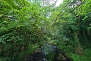
[Main photo: the River Walkham at Ward Bridge in the Walkham Valley] From high moor to the western border of Dartmoor National Park The River Walkham flows from remote, tussocky and boggy moorland on Dartmoor’s north moor through a heavily wooded valley to the western border of Dar...

Belstone and Cosdon Hill/Beacon Circular Walk, Belstone, Dartmoor National Park (approx. 6 miles away)
Cosdon Hill is a vast dome of moorland near the northern border of Dartmoor National Park. Given its size, there are plenty of walks and circular walks to the beacon and its summit and around its flanks. This walk starts at the village Belstone and takes you to the top of the hill before dropping do...

Brown's House (Ruin), Postbridge, Dartmoor National Park (approx. 6 miles away)
The West Dart River rises on Dartmoor National Park's high north plateau in boggy, rough cut moorland close to southern England's most remote spot at Fur Tor. The river builds strength as it flows south cutting moorland valleys on its way past Wistman's Wood National Nature Reserve to Tw...

East Dart River Waterfall, Postbridge, Dartmoor National Park (approx. 6 miles away)
With its rocky high ground and numerous rivers, Dartmoor National Park has many waterfalls. In Lydford Gorge (National Trust) and Canonteign Falls, water falls from a great height. In Becky Falls Woodland Park and Yealm Steps Waterfall, water tumbles dramatically over rocks. The waterfall on the upp...

Gidleigh Common, Chagford, Dartmoor National Park (approx. 6 miles away)
We include Gidleigh Common as a point of reference. People usually cross the common on their way to other places of interest in the National Park. For example, Scorhill Down and its famous stone circle are just south of Gidleigh Common. You also cross the common to walk up to White Moor Stone Circle...

Buttern Hill Stone Circle, Gidleigh, Dartmoor National Park (approx. 6 miles away)
There are many stone rows and circles on the moors above Chagford. Some, like Scorhill Stone Circle and The Grey Wethers Stone Circles, are well known and much visited. Others, like Fernworthy Stone Circle, are less well frequented because they are a little harder to find. Buttern Hill Stone Circle...

Belstone Cleave, Belstone, Dartmoor National Park (approx. 6 miles away)
By Dartmoor standards, Belstone Cleave is a relatively small cleave or wooded valley so it's easy to walk and explore. This website helps people discover and holiday in Dartmoor National Park. It's a practical guide. As such, for the purposes of this listing, we take Belstone Cleav...