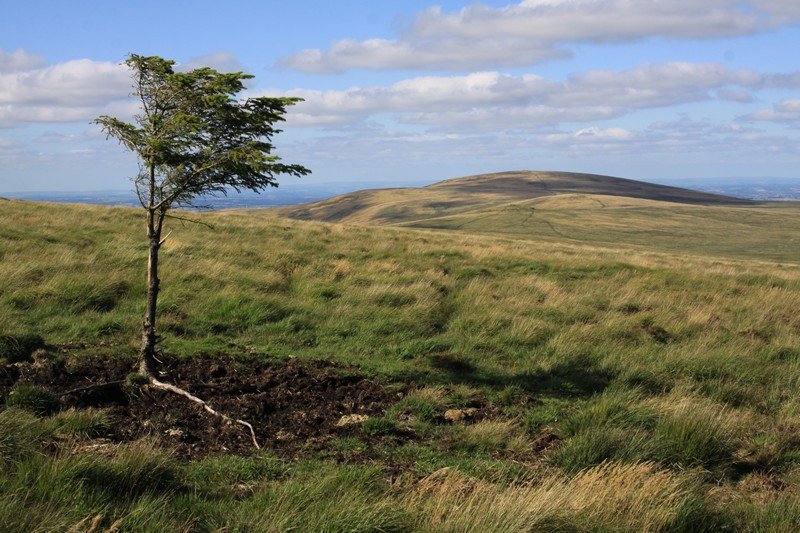
Cosdon Hill (Cawsand Hill), Belstone, Dartmoor National Park

Cosdon Hill, or Cawsand Hill, is one of the most recognisable natural features in Dartmoor. Its huge, shallow dome dominates the northern border of the National Park and is visible from miles around. You'll see Cosdon from the Haytor Rocks area in the eastern section of the Park and from the Yes Tor and High Willhays area to the north west. Hundreds of thousands of holidaymakers drive past the domed hill as they follow the A30 west into Cornwall. A smaller number yomp up its flanks to visit its big summit cairn. Given its location on the border of Dartmoor National Park, Cosdon Hill is very easily accessible but it takes a bit of effort to get to the top.
Because Cosdon Hill is such a large landmass, you can walk in from many starting points. The most obvious are Belstone, Sticklepath and Throwleigh. We've also made the trip to its summit from Gidleigh and Chagford to the south east and Okehampton Camp and Okehampton to the west.
Recommended route to Cosdon Hill for the first time
If it's your first trip, it's probably best to start from the pretty moorland village Belstone. Leave your car at the parking area at the entrance to the village and head to Belstone Cleave. An obvious grass track runs around the side of the north flank of the hill before connecting to another track that rises south to the summit. Consult the Ordnance Survey Explorer OL28 'Dartmoor' map for detail.
The summit is an unmistakable pile of rocks next to a trig point and rock shelters in which you can escape high winds. Given its size and visibility from miles around, Cosdon Hill was once used as a beacon that would have been lit in times of danger and celebration. Cosdon Beacon is marked on the Ordnance Survey Explorer OL28 'Dartmoor' map. There are many other beacon hills across Dartmoor including Hameldown Beacon, Buckland Beacon and Ugborough Beacon to the south. One can imagine a chain of fire running along the high moors.
The views, as you would expect, are huge. To the north, you look over Mid Devon to Exmoor National Park. To the west is the highest ground in southern England at Yes Tor and High Willhays. Beyond those are Conrwall and the North Cornwall coast. The high moors spread south and south west. Pretty, more gentle Devon countryside rolls to the east. Look out for the National Trust's Castle Drogo at the mouth of the Teign Gorge.
There are numerous points of interest around Cosdon Hill. The Cemetery is a fine triple stone row to the east. White Moor Stone and White Moor Stone Circle are to the south. The wonderful Belstone Cleave and Tarka Trail are to the north and lead to the National Trust's Finch Foundry (National Trust). Hills and tors around Cosdon include Steeperton Tor, Oke Tor and Belstone Tor. They're all beautiful.
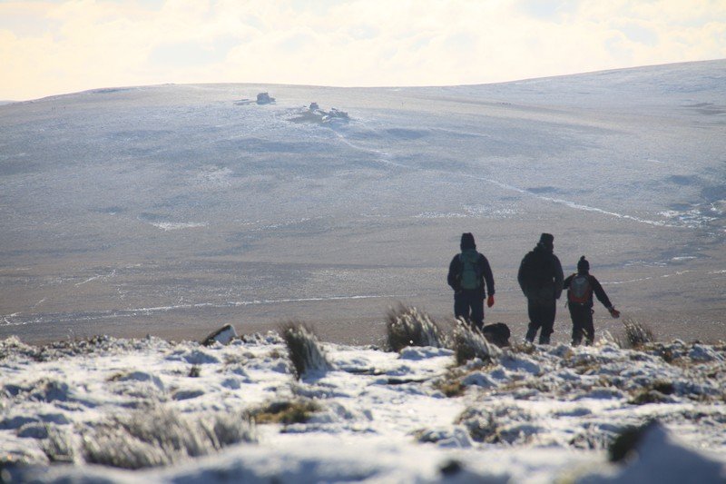
If you are an experienced and confident walker, we'd really recommend trudging up to the summit cairn after snow. The local authority do an excellent job of keeping the major Dartmoor access roads gritted during snowy weather so access to Sticklepath and Belstone is usually OK. You'll then make slow progress on the path that rises south to the top of the domed hill through increasingly deep snow. Note that it takes a lot longer to walk in snow and burns a lot more energy. Again, only try this if you are an experienced and confident walker. If going alone, run through all the usual safety checks such as telling people where you are going and taking the necessary equipment. Mobile phone reception is patchy on the high moors as well. Last, take sunglasses if the sun's out!
Other routes to the top of Cosdon
Because there are so many routes to the top of Cosdon, here are a few summary descriptions of routes to its summit cairn. They range from direct to slightly more circuitous. We've walked them all in pretty much every weather condition without problem. As a point of safety, you *must* avoid Raybarrow Pool and be careful if walking in Taw Marsh. Suggested routes include:
Walking Cosdon Hill from Throwleigh
Walking from Throwleigh. In our experience, this is the quickest route to the summit carin. Start from the small parking area by Shilstone Tor. Very obvious grass tracks take you up on to the moors. You can either head for the ford marked on the Ordnance Survey Explorer OL28 'Dartmoor' map or trend north west towards The Cemetery triple stone row. If you're walking the latter, you still have to cross a stream.
Walking Cosdon Hill from Belstone
Walking from Belstone. Follow the route described at the top of this listing. We wouldn't recommend a direct route as the crow flies as it's boggy and wet on the western flank of the hill.
Walking Cosdon Hill from Sticklepath
Walking from Sticklepath. Head into Belstone Cleave. You'll come to a signpost that guides you on to the moors. This route is a bit of a slog.
Walking Cosdon Hill from South Zeal area
Walking from South Zeal area. Follow the path that's marked on the Ordnance Survey Explorer OL28 'Dartmoor' map. It's a relatively easy trip to the top.
Walking Cosdon Hill from Gidleigh and Chagford areas
Walking from Gidleigh and Chagford areas. We've followed various paths from the Gidleigh and Chagford areas to Cosdon. If we had to choose one, we'd suggest you follow the grass tracks that run south of Kennon Hill to White Moor Stone and White Moor Stone Circle. You're on a flat ridgeline. Head to the top.
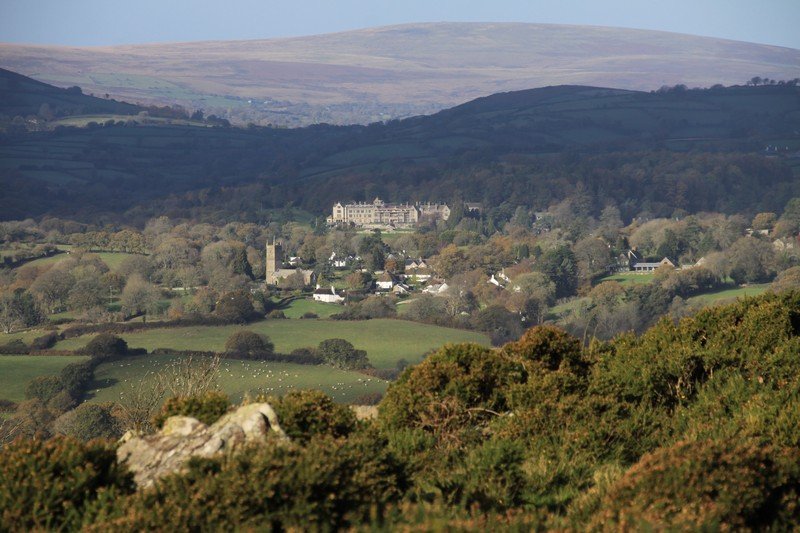
A long view of Codon Hill from Mid Devon
Last, if you like views, drive to Sampford Courtenay. Follow the A3072 west to Exbourne. From that road you get super views of the north of the National Park. Cosdon Hill features prominently.
Photo Gallery