Things To Do near Harford Moor

New Waste, Cornwood, Dartmoor National Park (approx. 2 miles away)
Whilst you can no longer park at New Waste, it still offers great access to the Stall Moor area of Dartmoor which includes the world's longest stone row in addition to arguably the finest stone row in the National Park near Stalldown Barrow. We've positioned New Waste on Google maps. Zoom in on t...

Erme Pound/Hook Lake Stone Row, South Brent, Dartmoor National Park (approx. 2 miles away)
Erme Pound/Hook Lake Stone Row is a short stone row just south east of Erme Pound by Hook Lake. If it weren't marked on the Ordnance Survey Explorer OL28 'Dartmoor' map, it would be difficult to find when exploring the area. The stones are small and obscured by long, moorland grass. We've po...

Zeal Tor Tramway (Dismantled), South Brent, Dartmoor National Park (approx. 2 miles away)
In his 'Guide To Dartmoor', William Crossing wrote: 'This track is really an old tramroad, over which peat was once conveyed to some naphtha works at Shipley, on the verge of Brent Moor. It has been disused for a very long time, but I can remember when the rails, which were of wood, bolted to blo...
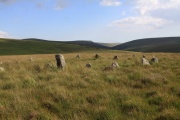
Stall Moor, Cornwood, Dartmoor National Park (approx. 2 miles away)
The River Erme and River Yealm rise on Dartmoor's south moor. They flow south to the border of the national park. Between them is Stall Moor. The terrain is difficult and boggy but the moor is peppered with amazing attractions from the world's longest stone row to a stunning waterfall. Stall Moor is...

Parking And Access To Dartmoor's South Moor, Harford, Dartmoor National Park (approx. 2 miles away)
Update 2021 Note that Harford Moor Gate car park is temporaily closed as of 2021. Click through to the listing to learn more. The easiest way to get to Harford Moor Gate and the south moor beyond is on foot. Start at Ivybridge and follow the Two Moors Way up onto the south moor. The Tw...

Harford Moor Gate, Harford, Dartmoor National Park (approx. 2 miles away)
Temporarily closed Harford Moor Gate car park is temporarily closed. A sign reads: 'Car park closed. This car park is on privately owned access land. It has been closed from February 2021. This has been done for two reasons. To help control footfall on this part of the moor. T...

Western White Barrow, South Brent, Dartmoor National Park (approx. 2 miles away)
There are two White Barrows above the Avon Dam Reservoir on Dartmoor's south moor. Eastern White Barrow is an extraordinary shape. Western White Barrow is less remarkable. Zeal Tor Tramway (Dismantled) and the Red Lake Railway (Dismatled)/Puffing Billy Track run nearby. The latter is the route of th...

Petre's Cross, South Brent, Dartmoor National Park (approx. 2 miles away)
In his 'Guide To Dartmoor', William Crossing wrote that 'Western Whitaburrow is generally referred to as Petre's Cross from the former existence on the cairn of a cross forming a bondmark of Sir William Petre's manor of Brent, where it abutted on the forest'. We've positioned Petre's Cross on Goo...

Hawns and Dendles Gorge, Cornwood, Dartmoor National Park (approx. 2 miles away)
The River Yealm rises at Yealm Head on Dartmoor's south moor. It flows to Yealm Steps Waterfall where is cascades into Hawns and Dendles Gorge as marked on the Harvey British Mountain Map 'Dartmoor' map. Zoom in on the accompanying Google map to see its location.

Dendles Wood National Nature Reserve, Cornwood, Dartmoor National Park (approx. 2 miles away)
This is one of Dartmoor's National Nature Reserves. However, you need a permit to visit the site. An information board on site reads: 'This wood is an example of old wood pasture. Oak and beech are the dominant tree species some beech trees being over 300 years old. The woodland supports a rich d...

River Yealm, Dartmoor, Dartmoor National Park (approx. 2 miles away)
There are a number of areas on Dartmoor's high north and south moors where many rivers, streams and brooks rise. The area around Cranmere Pool on the north moor is the most famous. On the south moor, the Langcombe Hill area is another. These areas are high, flat and very boggy. The River Yealm has i...

Eastern White Barrow, South Brent, Dartmoor National Park (approx. 2 miles away)
This is arguably the most distinctive barrow in Dartmoor National Park. Many barrows are larger. None has such an exaggerated shape. The views from the top are immense. It's also relatively easy to get to. We've positioned Eastern White Barrow on Google maps. Zoom in on the 'Satellite' setting to...

Yealm Steps, Cornwood, Dartmoor National Park (approx. 2 miles away)
Yealm Steps is one of Dartmoor National Park's many attractions and we'll be adding more information shortly.

Yealm Steps Waterfall, Cornwood, Dartmoor National Park (approx. 2 miles away)
A beautiful waterfall on remote, high moor roughly a kilometre south of Yealm Head, Yealm Steps Waterfall is in the upper section of Hawns and Dendles Gorge. The waterfall is reasonably close to Dendles Wood National Nature Reserve. Stall Moor, with its extraordinary stone rows, is to the east. The...

Shipley Bridge, South Brent, Dartmoor National Park (approx. 2 miles away)
This is one of the major access points to Dartmoor's south moor. There's a car parking area, toilets and information boards. A tarmac road (not open to vehicles owned by the public) winds its way up the Avon Dam Reservoir Valley to Avon Dam Reservoir. The road follows, and crosses, the River Avon. M...