Things To Do near Penn Moor

Dartmoor East To West Walk/Crossing In A Day, Dartmoor, Dartmoor National Park (approx. 9 miles away)
Open access moorland Dartmoor National Park is, in the main, open access. This means that you can take many routes across the moor. Some, like the Abbot's Way and Lichway/Lych Way, are marked in part on the Ordnance Survey Explorer OL28 'Dartmoor' map or the Harvey British Mountain Maps 'Dar...

Wistman's Wood Ford, Two Bridges, Dartmoor National Park (approx. 9 miles away)
Wistman's Wood is an extraordinary National Nature Reserve located in a valley cut by the West Dart River on the egde of Dartmoor's high north plateau. Wistman's Wood Ford is a place where you can, in good conditions, cross the West Dart River. The ford is roughly one kilometre north of...

Bellever Clapper Bridge, Bellever, Dartmoor National Park (approx. 9 miles away)
East Dart River clapper bridges Follow the East Dart River south of Postbridge Clapper Bridge and you'll come to Bellever Clapper Bridge on the edge of Bellever Forest. Lichway/Lych Way Bellever Clapper Bridge is on the route of the ancient Lichway/Lych Way.

Lydford Tor, Princetown, Dartmoor National Park (approx. 9 miles away)
The Lichway/Lych Way runs, roughly speaking, between Bellever Forest in the heart of Dartmoor to Lydford on the western border of the National Park. For centuries, people working the moors had to carry their dead across the moors to bury them at Lydford Church. Lydford Tor is situated by the Lichway...

Roos Tor, Merrivale, Dartmoor National Park (approx. 9 miles away)
Roos is the northernmost tor in a cluster of outcrops on the western side of Dartmoor National Park. It's near the stunning and much photographed Great Staple Tor and overlooks Langstone Moor with its stone circle, standing stone and stone row. Great Mis Tor dominates to the east. The view north alo...

Cox, Roos and the Staple Tors Circular Walk, Tavistock, Dartmoor National Park (approx. 9 miles away)
Walking to one of Dartmoor's most impressive and photographed tors This walk takes you to Great Staple Tor which is one of Dartmoor National Park's most impressive and photographed tors. The walk also provides huge views over the Westcountry. The terrain is relatively easy and the walk...

Kraps Ring Settlement, Bellever, Dartmoor National Park (approx. 9 miles away)
Ancient settlement in Bellever Forest near Postbridge Kraps Ring is the most impressive of the Bellever Settlements. We've postioned Kraps Ring on Google maps so zoom in on the 'Satellite' setting to see its location. Learning more about settlements on Dartmoor To learn more...

Cox Tor, Merrivale, Dartmoor National Park (approx. 9 miles away)
Awesome views. Great place from which to watch the sun set over the Westcountry. Very easily accessible from a large car parking area on the western edge of Dartmoor's high moor. Cox Tor is also superb as part of a circular walk taking in Roos Tor and The Staple Tors. We've positioned Cox Tor on...

Double Waters, Yelverton, Dartmoor National Park (approx. 9 miles away)
The River Walkham meets the River Tavy at Double Waters on the western border of Dartmoor National Park. It's a beautiful place that's popular with wild swimmers and walkers. The long distance path the West Devon Way runs through here. We've positioned Double Waters on Google maps. Zoom in on the...
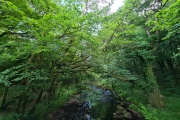
River Walkham, Dartmoor, Dartmoor National Park (approx. 9 miles away)
[Main photo: the River Walkham at Ward Bridge in the Walkham Valley] From high moor to the western border of Dartmoor National Park The River Walkham flows from remote, tussocky and boggy moorland on Dartmoor’s north moor through a heavily wooded valley to the western border of Dar...

Crow Tor, Two Bridges, Dartmoor National Park (approx. 9 miles away)
Head up the valley from Two Bridges to Wistman's Wood and you'll see a distinctive lump of granite on a spur of land to the north. This is Crow Tor. The spur of land is cut by the West Dart River to the east and south and by a small moorland stream to the west. North, the moorland rises from Crow To...

Hutholes Abandoned Medieval Settlement, Widecombe in the Moor, Dartmoor National Park (approx. 9 miles away)
An information board on site reads that 'this is the site of a deserted medieval settlement known today as Hutholes. Within an area of just under an acre lie the remains of six buildings dating to the 13th and 14th centuries A.D.' We've positioned Hutholes on Google maps so zoom in on the 'Satell...

Dartmoor North To South Walk In A Day, Dartmoor, Dartmoor National Park (approx. 10 miles away)
You can walk from Belstone near the northern border of Dartmoor down to Ivybridge on the southern border of the National Park in a day. Providing you don't get lost, it takes roughly twelve hours so you'll need to do it when there are sufficient daylight hours unless, of course, you want to walk by...

Wind Tor, Widecombe in the Moor, Dartmoor National Park (approx. 10 miles away)
A section of the Two Moors Way runs along the spine of Hamel Down and then descends to Dunstone Down and Bittleford Down before moorland meets a mosaic of small fields. At the southern end of this moorland, where Dunstone Down merges into Bittleford Down, is Wind Tor. It's one of Dartmoor's flat out...

Buckland Beacon, Buckland in the Moor, Dartmoor National Park (approx. 10 miles away)
Many Dartmoor locals think the views from Buckland Beacon are the best in the National Park. Most views this big and special take a lot of effort to get to. Buckland Beacon is very easily accessible and a simple stroll from car parking areas along the nearby road. The Oxford English Dictionary de...