Things To Do near Yarner Wood Reserve Base/Natural England Office

Down Tor, Princetown, Dartmoor National Park (approx. 14 miles away)
Down Tor is a beautiful cluster of outcrops relatively close to the eastern end of Burrator Reservoir and Norsworthy Bridge. It offers 360 degree views of Dartmoor's western tors, south moor and sublime Burrator Reservoir. Down Tor Stone Row (Hingston Hill Stone Row), which is one of the National Pa...

Yealm Steps, Cornwood, Dartmoor National Park (approx. 14 miles away)
Yealm Steps is one of Dartmoor National Park's many attractions and we'll be adding more information shortly.

Yealm Steps Waterfall, Cornwood, Dartmoor National Park (approx. 14 miles away)
A beautiful waterfall on remote, high moor roughly a kilometre south of Yealm Head, Yealm Steps Waterfall is in the upper section of Hawns and Dendles Gorge. The waterfall is reasonably close to Dendles Wood National Nature Reserve. Stall Moor, with its extraordinary stone rows, is to the east. The...

Drizzle Combe Stone Rows, Sheepstor, Dartmoor National Park (approx. 14 miles away)
In his superb 'The Field Archaeoogy of Dartmoor', Phil Newman writes: 'The majority of menhirs are associated with stone rows, forming the terminals at one end of the row. These may have existed before the rows were added or were erected as a deliberate element of the row. The three stone rows at...
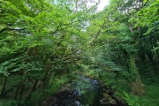
River Walkham, Dartmoor, Dartmoor National Park (approx. 14 miles away)
[Main photo: the River Walkham at Ward Bridge in the Walkham Valley] From high moor to the western border of Dartmoor National Park The River Walkham flows from remote, tussocky and boggy moorland on Dartmoor’s north moor through a heavily wooded valley to the western border of Dar...

Drizzle Combe Giant's Basin, Sheepstor, Dartmoor National Park (approx. 14 miles away)
In 'High Dartmoor', Eric Hemery wrote: 'The huge despoiled cairn near the barrow heading the southernmost row is known as Giants Basin [sic]; Bill Pengelly told me that many of its stones were taken by Ditsworthy warreners for constructing their rabbit-buries.'

Shavercombe Head, Sheepstor, Dartmoor National Park (approx. 14 miles away)
Langcombe Hill is a huge, flat area of moorland on Dartmoor's high south moor. Many rivers and brooks rises on its flanks. Erme Head is to the north. Yealm Head is to the south. Shavercombe Head is to the west. From its headwaters, Shavercombe Brook runs down to Shavercombe Waterfall and Shaverco...

River Yealm, Dartmoor, Dartmoor National Park (approx. 14 miles away)
There are a number of areas on Dartmoor's high north and south moors where many rivers, streams and brooks rise. The area around Cranmere Pool on the north moor is the most famous. On the south moor, the Langcombe Hill area is another. These areas are high, flat and very boggy. The River Yealm has i...

Langstone Moor Stone Circle, Peter Tavy, Dartmoor National Park (approx. 14 miles away)
Dartmoor's stone circles tend to occupy stunning locations. Langstone Moor Stone Circle is no exception. Situated in a vast, open stretch of moorland with the bulk of Great Mis Tor rising to the south east, Langstone Moor Stone Circle is essential visiting if you're interested in Dartmoor's prehisto...

Drizzle Combe Standing Stones, Sheepstor, Dartmoor National Park (approx. 14 miles away)
Dartmoor National Park is home to the highest point in southern England, the longest stone row in the world and the most remote spot in the Westcountry. It's also where you'll find a high number of standing stones or menhirs. The tallest, at over 3 metres, is at Drizzle Combe. One of three...

Belstone and West Cleave Circular Walk, Belstone, Dartmoor National Park (approx. 14 miles away)
Use the Ordnance Survey Explorer OL28 'Dartmoor' map in conjunction with our photographs and Google mapping. Start at the large car parking area on the northern side of Belstone village. Given the area's popularity, you're asked to park here as a visitor. Walk into the village and take the r...

Sandy Ford (Upper West Okement Valley), Okehampton, Dartmoor National Park (approx. 14 miles away)
Crossing Dartmoor's major rivers can be difficult. Thankfully, there are plenty of granite bridges, wooden bridges, modern suspension bridges, clapper bridges, stepping stones and fords to help you cross these waterways. Sandy Ford enables you to cross the upper section of the West Okement River nea...

High Willhays, Okehampton, Dartmoor National Park (approx. 14 miles away)
Dartmoor's highest ground is in the north west section of the National Park. Near Okehampton, the moors rise to a broad ridgeline on which are two tors. The most impressive tor at the northern end of the ridgeline is called Yes Tor. At the southern end is Dartmoor's highest summit High Willhays. The...

Chapel Ford (and 'Chapel Lands'), Okehampton, Dartmoor National Park (approx. 14 miles away)
If you're walking the Tarka Trail in Dartmoor National Park, you'll cross the wooden footbridge at Chapel Ford on the East Okement River at the upper end of West Cleave. The ford is just downstream of the footbridge. There's also a set of stepping stones. The Tarka Trail runs along the west bank mov...

Shavercombe Tor and Waterfall, Sheepstor, Dartmoor National Park (approx. 14 miles away)
Shavercombe Tor is a relatively small collection of outcrops and granite boulders on the western bank of Shavercombe Brook on the edge of Dartmoor's high south moor. The tor is near a waterfall and pool that are popular with Dartmoor enthusiasts and wild swimmers. We've positioned Shave...