Things To Do near Yarner Wood Reserve Base/Natural England Office

Plym Steps, Sheepstor, Dartmoor National Park (approx. 13 miles away)
'Steps' on Dartmoor usually refer to stepping stones. Stepping stones are often necessary to cross the National Park's many rivers. However, stones are often moved by the power of the water when rivers are in spate. When this happens, the stones can either be repositioned or the set of stepping ston...

Ugborough Moor, South Brent, Dartmoor National Park (approx. 13 miles away)
Dartmoor is split into two areas of high moorland. The north moor is in the northern section of the National Park. The south moor is in the southern section. These vast areas of moorland are further split into smaller sections. Ugborough Moor is one of them. If you look at the Ordnance Survey Explor...

Amicombe Brook, Mary Tavy, Dartmoor National Park (approx. 13 miles away)
You're most likely to walk along, or cross, Amicombe Brook when heading to Fur Tor and the heart of Dartmoor's north moor from the western side of the National Park. The brook rises in an exceptionally boggy valley on remote moorland between Amicombe Hill and Great Kneeset. It passes Dinger Pool and...

Best Dartmoor Winter Things To Do, Dartmoor, Dartmoor National Park (approx. 13 miles away)
[Main photo: Steeperton Tor from the southern section of Belstone Ridge near Higher Tor in winter] Dartmoor National Park is a complex place. You'll experience rolling countryside, heavily wooded valleys, forests and national nature reserves as you explore its landscape. That said, the...
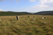
Stall Moor, Cornwood, Dartmoor National Park (approx. 13 miles away)
The River Erme and River Yealm rise on Dartmoor's south moor. They flow south to the border of the national park. Between them is Stall Moor. The terrain is difficult and boggy but the moor is peppered with amazing attractions from the world's longest stone row to a stunning waterfall. Stall Moor is...

Broad Amicombe Hole, Lydford, Dartmoor National Park (approx. 14 miles away)
Broad Amicombe Hole is marked on the Harvey British Mountain Map ‘Dartmoor’ map. It’s a steep-sided valley between Amicombe Hill and Great Kneeset just south of Lints Tor. Grass paths run across Amicombe Hill to Broad Amicombe Hole and up to Great Kneeset. You’ll often find Ten Tors teams pr...

Hollow Tor, Princetown, Dartmoor National Park (approx. 14 miles away)
Princetown is situated east and south east of the Dartmoor landmark North Hessary Tor and Radio Mast. To the west, the moor drops down to Foggintor Quarries and English Heritage's Merrivale Complex. Between these points of interest is Hollow Tor. Small by Dartmoor standards, Hollow Tor is located...

Crazy Well Cross, Princetown, Dartmoor National Park (approx. 14 miles away)
The Buckfast to Tavistock Monastic Route runs between Buckfast Abbey and Tavistock Abbey. It passes over high moor and is lined with crosses. Where high moor descends to the Burrator Reservoir area are a number of crosses including Crazy Well Cross. It's named after nearby Crazy Well Pool. We've...

River Taw, Belstone, Dartmoor National Park (approx. 14 miles away)
For anyone who loves the poetry of Ted Hughes, the River Taw should be a very special place. Near Taw Head, where the river rises, is a simple granite memorial stone to the Poet Laureate. Sunk into a mound on the west bank of the river, a visit to the memorial stone on a walk from Belstone is a grea...

Dinger Tor, Okehampton, Dartmoor National Park (approx. 14 miles away)
An army ring road pushes out from Okehampton Camp on Dartmoor's north moor. On the ground, this army ring road is in fact a network of roads and tracks that provide easy access to remote moorland. At the south western extent of this ring road is Dinger Tor. It's a small rocky outcrop overlooking a l...

Belstone Common, Belstone, Dartmoor National Park (approx. 14 miles away)
On the Ordnance Survey Explorer OL28 'Dartmoor' map, Belstone Common is marked as moorland between the River Taw and East Okement River covering Watchet Hill and Belstone Tors. 'Holiday in Dartmoor' is a practical guide to the National Park so our emphasis here is access points to the moor....

Crazy Well Pool, Princetown, Dartmoor National Park (approx. 14 miles away)
Popular with wild swimmers, Crazy Well Pool is a large, deep pit filled with water. The pit was created by tin miners. A gert, or valley cut by miners, runs south of the pool. Crazy Well Cross is to the east and is on the Buckfast to Tavistock Monastic Route. The Granite and Gears Princetown an...

Sharp Tor (South Dartmoor), Harford, Dartmoor National Park (approx. 14 miles away)
This tor rises above the rare high altitude oak woodlands Piles Copse in the southern section of Dartmoor National Park. The views over Piles Copse/Piles Valley to Stalldown Barrow and the remote south moor are amazing. Three Barrows are, roughly speaking, to the north. The Two Moors Way passes...

Belstone Great Green, Belstone, Dartmoor National Park (approx. 14 miles away)
There's a car park on the right as you enter Belstone. Walk from this car park towards The Tors Inn and Belstone Church and you'll see a small village green with stocks to the left. There are two roads. Follow the left hand road and you come to a pub garden and a large grassy area that drops steeply...

Down Tor Stone Row (Hingston Hill Stone Row), Princetown, Dartmoor National Park (approx. 14 miles away)
This is arguably the most extraordinary stone row on Dartmoor. Whilst Stall Moor Stone Row is the longest in the world and Stalldown Stone Row has the tallest collection of stones, for sheer presence it's hard to beat Down Tor Stone Row (Hingston Hill Stone Row). This is essential visiting when...