Things To Do near Princetown Railway (Princetown to Yelverton Railway Dismantled)

Kraps Ring Settlement, Bellever, Dartmoor National Park (approx. 6 miles away)
Ancient settlement in Bellever Forest near Postbridge Kraps Ring is the most impressive of the Bellever Settlements. We've postioned Kraps Ring on Google maps so zoom in on the 'Satellite' setting to see its location. Learning more about settlements on Dartmoor To learn more...

Red Lake Ford, South Brent, Dartmoor National Park (approx. 6 miles away)
Each year, many people follow the path marked 'Abbot's Way' on the Ordnance Survey Explorer OL28 'Dartmoor' map. This path crosses Dartmoor's high south moor. Because so many rivers and streams rise on the high south moor, you have to ford these waterways when following the route. One of the most is...

Red Lake China Clay Works, South Brent, Dartmoor National Park (approx. 6 miles away)
Drive the A30 through Cornwall and you'll see the impressive sky tips of the Cornish Alps or White Alps created by the local china clay works. Walk the moor above Plymouth and you'll look down on the huge china clay works at, among others, Shaugh Lake, Lee Moor and Whitehill Yeo. Smaller, more...

Tavistock Canal Northern Tunnel Portal, Tavistock, Dartmoor National Park (approx. 6 miles away)
If you zoom in on the 'Satellite' setting of the accompanying Google map, you'll be at the entrance of a tunnel that passes under a patchwork of fields that covers Morwell Down. This entrance is called the Tavistock Canal Northern Tunnel Portal. Move the map south west and you'll come to M...

Nat Tor, Mary Tavy, Dartmoor National Park (approx. 6 miles away)
Nat Tor is a small outcrop situated at the tail of Tavy Cleave in the western section of Dartmoor National Park. It's one of a number of tors lining the northern lip of Tavy Cleave. We've positioned Nat Tor on Google maps so zoom in on the 'Satellite' setting to see its location. To visit for...

Erme Pound, South Brent, Dartmoor National Park (approx. 6 miles away)
A pound is an enclosure or space surrounded by a wall. The Erme is a river flowing from Dartmoor's south moor down to the South Devon coast. Erme Pound is an enclosure in the heart of Dartmoor's south moor reasonably close to the headwaters, or start, of the River Erme. In his book 'High Dartmoor...

Penn Moor, Cornwood, Dartmoor National Park (approx. 6 miles away)
Penn Moor is situated at the southern egde of Dartmoor's south moor. It rises above Dendles Wood National Nature Reserve and China Clay Workings. It's topped by Penn Beacon.

Ponies on Dartmoor, Dartmoor, Dartmoor National Park (approx. 6 miles away)
If you head out on to the moors or hills of Dartmoor National Park, it's very likely you'll see ponies. We've photographed ponies and their foals all over the Park and, because they're free to roam, it's difficult to recommend exact locations in which to see them. There are various types of pony...

Lanehead, Mary Tavy, Dartmoor National Park (approx. 6 miles away)
Lanehead is a car parking area on the western side of Dartmoor. Just up the road from Mary Tavy, Lanehead provides excellent access to some of the best tors and high moorland in this section of the National Park. It's also by the stunning Tavy Cleave. We include Lanehead on this site as a point of r...

Penn Beacon, Cornwood, Dartmoor National Park (approx. 6 miles away)
The Oxford English Dictionary defines a beacon as 'a fire or light set up in a high or prominent position as a warning, signal, or celebration’. There is a chain of beacons on Dartmoor running from the edge of the north moor down to the edge of the south moor. Penn Beacon is at the edge...

Ryder's Hill, Dartmeet, Dartmoor National Park (approx. 6 miles away)
Dartmoor National Park consists of two high moorland plateaus separated by a central dip and fringed by stunning wooded valleys. High Willhays is the highest point on the north plateau. Ryder's Hill is the highest point on the south plateau. Ryder's Hill is a shallow dome of moorland near the sou...

Bellever Tor & Forest Circular Walk, Bellever, Dartmoor National Park (approx. 6 miles away)
Bellever Tor Explore the heart of Dartmoor around Bellever Tor. The tor is a local beauty spot known for its excellent panoramic views. We describe lots of different routes to this beauty spot in our Bellever Tor listing. The circular walk outlined below takes in forest, moorland and tors...
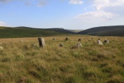
Stall Moor, Cornwood, Dartmoor National Park (approx. 6 miles away)
The River Erme and River Yealm rise on Dartmoor's south moor. They flow south to the border of the national park. Between them is Stall Moor. The terrain is difficult and boggy but the moor is peppered with amazing attractions from the world's longest stone row to a stunning waterfall. Stall Moor is...

Yealm Steps, Cornwood, Dartmoor National Park (approx. 6 miles away)
Yealm Steps is one of Dartmoor National Park's many attractions and we'll be adding more information shortly.

Yealm Steps Waterfall, Cornwood, Dartmoor National Park (approx. 6 miles away)
A beautiful waterfall on remote, high moor roughly a kilometre south of Yealm Head, Yealm Steps Waterfall is in the upper section of Hawns and Dendles Gorge. The waterfall is reasonably close to Dendles Wood National Nature Reserve. Stall Moor, with its extraordinary stone rows, is to the east. The...