Things To Do near Sheepstor Brook Ford and Scout Hut Copse

Rider's Rings, South Brent, Dartmoor National Park (approx. 6 miles away)
Rider's Rings, or Ryder's Rings, is an ancient settlement on high moorland situated on the western lip of the Avon Dam Reservoir Valley. We've positioned Rider's Rings on Google maps. Zoom in on the 'Satellite' setting to see its location. To visit, head for the car parking area at Shipley Bridge...

Red Lake Railway (Dismantled)/Puffing Billy Track, Harford, Dartmoor National Park (approx. 6 miles away)
Red Lake Railway transported workers and equipment from Bittaford and the Ivybridge area to Red Lake China Clay Works. It carried back waste material to be used as fertiliser. Built between 1910 and 1912, the remaining trackbed is now a long but solid path that takes you into the heart of Dartmoo...

Beardown Tors, Two Bridges, Dartmoor National Park (approx. 6 miles away)
Cluster of outcrops overlooking the West Dart River and Wistman's Wood National Nature Reserve Many of Dartmoor's most beautiful locations are shaped by rivers. The Dart Gorge, Teign Gorge, Tavy Cleave and Lustleigh Cleave are all cut by rivers flowing from the high moor. The river valley just no...

Wistman's Wood National Nature Reserve, Two Bridges, Dartmoor National Park (approx. 6 miles away)
Rare, high altitude oak woodland Piles Copse, Black-a-Tor Copse and Wistman's Wood are rare, high altitude oak woodlands in Dartmoor National Park. Piles Copse is situated towards the southern border of Dartmoor near the village Harford. Black-a-Tor Copse is situated below Dartmoor's highest g...

Dartmoor Live Firing, Dartmoor, Dartmoor National Park (approx. 7 miles away)
If you see one of these flags then the army are using the area for live firing. You'll hear the gunfire well before you see red flags but, still, do look out for them. They're positioned on the highest ground so you can't miss them. Dartmoor has three army ranges: Okehampton, Wilsworthy and Merri...

Avon Dam Reservoir Circular Walk, South Brent, Dartmoor National Park (approx. 7 miles away)
This circular walk takes in a beautiful river valley, one of Dartmoor's most stunning reservoir settings and high moorland. It also includes a short stretch of the Abbot's Way as marked on Ordnance Survey maps. Highly recommended if you want to explore the south eastern corner of Dartmoor Natio...
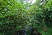
River Walkham, Dartmoor, Dartmoor National Park (approx. 7 miles away)
[Main photo: the River Walkham at Ward Bridge in the Walkham Valley] From high moor to the western border of Dartmoor National Park The River Walkham flows from remote, tussocky and boggy moorland on Dartmoor’s north moor through a heavily wooded valley to the western border of Dar...

Avon Dam Reservoir Valley, South Brent, Dartmoor National Park (approx. 7 miles away)
The River Avon rises on remote moorland and flows into the Avon Dam Reservoir. From there, beyond the dam wall, it cuts a stunning valley as it meanders down to the car parking area at Shipley Bridge. The stretch of valley between the dam and Shipley Bridge is exceptionally popular with wa...

Double Waters, Yelverton, Dartmoor National Park (approx. 7 miles away)
The River Walkham meets the River Tavy at Double Waters on the western border of Dartmoor National Park. It's a beautiful place that's popular with wild swimmers and walkers. The long distance path the West Devon Way runs through here. We've positioned Double Waters on Google maps. Zoom in on the...

Dart Gorge Dartmeet to Luckey Tor North Bank Walk, Dartmeet, Dartmoor National Park (approx. 7 miles away)
Just across the road from the large car parking area at Dartmeet is a viewing point where you can see the East Dart River and West Dart River merge to form the Double Dart or, as it's more commonly known, the River Dart. There are chunky granite steps leading down in to the water for those wanting a...

West Dart River, Dartmoor, Dartmoor National Park (approx. 7 miles away)
Dartmouth is one of the UK's most beautiful towns. Strung out along a steep-sided bank of the Dart Estuary where the river meets the South Devon coast, the town is packed with domestic and international tourists. Follow the river up to its two sources at the West Dart Head and East Dart Head on...

Dartmoor Cream Teas, Two Bridges, Dartmoor National Park (approx. 7 miles away)
Most major visitor attractions, hotels, pubs and cafes sell cream teas on Dartmoor. Whilst exploring and photographing the National Park, we've enjoyed cream teas in the following superb locations and would recommend visits. National Trust Castle Drogo. Finch Foundry. Lydf...

Powdermills Pottery Cream Tea, Two Bridges, Dartmoor National Park (approx. 7 miles away)
This is a great spot for a cream tea, some shopping and an explore of one of Dartmoor's more quirky points of interest at Powdermills. There's parking available but it's also fun to walk in on the ancient Lichway/Lych Way via either Two Bridges or Postbridge/Bellever Forest. We've positio...

Powdermills Pottery, Two Bridges, Dartmoor National Park (approx. 7 miles away)
Drive the B3212 through the heart of Dartmoor National Park and you'll see tall chimney stacks and a cluster of buildings in a remote moorland location near Bellever Forest. This is where gunpowder used to be manufactured. Today, it's the location of local businesses including Powdermills Pottery...

Dartmoor East To West Walk/Crossing In A Day, Dartmoor, Dartmoor National Park (approx. 7 miles away)
Open access moorland Dartmoor National Park is, in the main, open access. This means that you can take many routes across the moor. Some, like the Abbot's Way and Lichway/Lych Way, are marked in part on the Ordnance Survey Explorer OL28 'Dartmoor' map or the Harvey British Mountain Maps 'Dar...