Things To Do near Ingra Tor

Bellever Prehistory Walk, Bellever, Dartmoor National Park (approx. 6 miles away)
Postbridge National Park Visitor Centre Start at the Postbridge National Park Visitor Centre across the road from the famous Postbridge Clapper Bridge. There's plenty of parking outside the visitor centre. Before you walk, head into the visitor centre and pop upstairs to see the excelle...

Lanehead, Mary Tavy, Dartmoor National Park (approx. 6 miles away)
Lanehead is a car parking area on the western side of Dartmoor. Just up the road from Mary Tavy, Lanehead provides excellent access to some of the best tors and high moorland in this section of the National Park. It's also by the stunning Tavy Cleave. We include Lanehead on this site as a point of r...

Red Lake Ford, South Brent, Dartmoor National Park (approx. 6 miles away)
Each year, many people follow the path marked 'Abbot's Way' on the Ordnance Survey Explorer OL28 'Dartmoor' map. This path crosses Dartmoor's high south moor. Because so many rivers and streams rise on the high south moor, you have to ford these waterways when following the route. One of the most is...

Red Lake China Clay Works, South Brent, Dartmoor National Park (approx. 6 miles away)
Drive the A30 through Cornwall and you'll see the impressive sky tips of the Cornish Alps or White Alps created by the local china clay works. Walk the moor above Plymouth and you'll look down on the huge china clay works at, among others, Shaugh Lake, Lee Moor and Whitehill Yeo. Smaller, more...

Erme Pound, South Brent, Dartmoor National Park (approx. 6 miles away)
A pound is an enclosure or space surrounded by a wall. The Erme is a river flowing from Dartmoor's south moor down to the South Devon coast. Erme Pound is an enclosure in the heart of Dartmoor's south moor reasonably close to the headwaters, or start, of the River Erme. In his book 'High Dartmoor...

Yealm Steps, Cornwood, Dartmoor National Park (approx. 7 miles away)
Yealm Steps is one of Dartmoor National Park's many attractions and we'll be adding more information shortly.

Yealm Steps Waterfall, Cornwood, Dartmoor National Park (approx. 7 miles away)
A beautiful waterfall on remote, high moor roughly a kilometre south of Yealm Head, Yealm Steps Waterfall is in the upper section of Hawns and Dendles Gorge. The waterfall is reasonably close to Dendles Wood National Nature Reserve. Stall Moor, with its extraordinary stone rows, is to the east. The...

Bellever Cairn Circles and Cists, Bellever, Dartmoor National Park (approx. 7 miles away)
Postbridge National Park Visitor Centre We'd recommend visiting Postbridge National Park Visitor Centre before exploring Bellever's prehistory. Whilst the second floor Dartmoor prehistory exhibition covers all aspects of the area's distance past, there's a section concentrating on the 'la...

Bellever Stone Rows (Lakehead Hill Stone Rows), Bellever, Dartmoor National Park (approx. 7 miles away)
60% of all stone rows to be found in England are on Dartmoor Visit the Dartmoor prehistory exhibition on the top floor of Postbridge National Park Visitor Centre and you'll read that '60% of all stone rows to be found in England are on Dartmoor and a third of all stone rows in the UK and Bri...
Stall Moor, Cornwood, Dartmoor National Park (approx. 7 miles away)
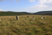
The River Erme and River Yealm rise on Dartmoor's south moor. They flow south to the border of the national park. Between them is Stall Moor. The terrain is difficult and boggy but the moor is peppered with amazing attractions from the world's longest stone row to a stunning waterfall. Stall Moor is...

Bellever Forest, Bellever, Dartmoor National Park (approx. 7 miles away)
Dartmoor’s moors and tors are world famous. Less well known are the extraordinarily beautiful wooded valleys that fringe the high ground. There are a number of stunning forests as well. The largest, between Chagford and Postbridge, is Fernworthy Forest. By Postbridge, in the heart of Dartmoor Nati...

West Dart Head, Postbridge, Dartmoor National Park (approx. 7 miles away)
The River Dart rises in two places on Dartmoor's north plateau. The East Dart River rises at East Dart Head near Cranmere Pool and Whitehorse Hill. The West Dart River rises at West Dart Head near Cut Hill and Fur Tor. To help you identify the source of the West Dart River, we've posi...

Nattor Down, Mary Tavy, Dartmoor National Park (approx. 7 miles away)
Nattor Down is a section of moorland on the edge of Willsworthy Range. The car parking area at Lanehead leads to Nattor Down. You cross Nattor Down to reach the stunning Ger Tor and Tavy Cleave Tors overlooking Tavy Cleave. We've positioned Nattor Down on Google maps. Zoom in on the 'Satelli...

Huccaby Stepping Stones/Huccaby Steps, Hexworthy, Dartmoor National Park (approx. 7 miles away)
If you locate Dartmeet on the Ordnance Survey Explorer OL28 'Dartmoor' map, you'll see a green path crossing the West Dart River running to/from the Combestone Tor area. This is the location of Dartmeet Stepping Stones. Follow the West River Dart upstream as it bows towards Hexworthy and Huccaby and...

Kraps Ring Settlement, Bellever, Dartmoor National Park (approx. 7 miles away)
Ancient settlement in Bellever Forest near Postbridge Kraps Ring is the most impressive of the Bellever Settlements. We've postioned Kraps Ring on Google maps so zoom in on the 'Satellite' setting to see its location. Learning more about settlements on Dartmoor To learn more...