Things To Do near Middle Tor

Langstone Moor Stone Circle, Peter Tavy, Dartmoor National Park (approx. 8 miles away)
Dartmoor's stone circles tend to occupy stunning locations. Langstone Moor Stone Circle is no exception. Situated in a vast, open stretch of moorland with the bulk of Great Mis Tor rising to the south east, Langstone Moor Stone Circle is essential visiting if you're interested in Dartmoor's prehisto...

Lanehead, Mary Tavy, Dartmoor National Park (approx. 8 miles away)
Lanehead is a car parking area on the western side of Dartmoor. Just up the road from Mary Tavy, Lanehead provides excellent access to some of the best tors and high moorland in this section of the National Park. It's also by the stunning Tavy Cleave. We include Lanehead on this site as a point of r...

Dunsford Local Nature Reserve, Dunsford, Dartmoor National Park (approx. 8 miles away)
Run by the Devon Wildlife Trust in woods owned by the National Trust, Dunsford Nature Reserve is best known for its early show of wild daffodils at the onset of Spring. We'd recommend this Dunsford Wood Wild Daffodil Circular Walk. To visit Dunsford Nature Reserve, head for Steps Bridge near D...

Swincombe, Hexworthy, Dartmoor National Park (approx. 8 miles away)
Swincombe is a collection of ruined, disused buildings just west of Hexworthy. It's named on the Harvey British Mountain Map 'Dartmoor' map. The buildings are drawn on an area of private land on the Ordnance Survey Explorer OL28 'Dartmoor' map but not named. Swincombe consists of Higher/Upper and...

Swincombe Bridge (Swincombe Fairy Bridge/Swincombe Ford Bridge), Hexworthy, Dartmoor National Park (approx. 8 miles away)
The River Swincombe rises on the edge of Dartmoor's south plateau. It flows into Foxtor Mires where it meets Strane River at Headweir Ford. From there, it picks up speed and tumbles through a very pretty valley to a reservoir. Downstream of the reservoir, by the ruined buildings at Swincombe, is the...

Southerly Down, Lydford, Dartmoor National Park (approx. 8 miles away)
Southerly Down provides access from the Granite Way to the high moor near the western boundary of Dartmoor National Park. Coombe Down is to the north east. Great Nodden is to the east and south east. King Wall, the King Way and a section of the Rattlebrook Peatworks Railway (Disused) run across the...

Standon Steps, Mary Tavy, Dartmoor National Park (approx. 8 miles away)
This information is taken from 'Walking Dartmoor's Ancient Tracks' by the Dartmoor expert Eric Hemery: 'The simplest way to explain the remarkable Standon Steps is to quote the relevant passage from 'High Dartmoor': The alarming rapidity and volume of Tavy (prior to dep...

Yarrow Mine/Devon Wheal Francis/Yarner Copper Mine, Bovey Tracey, Dartmoor National Park (approx. 8 miles away)
At Yarner Wood Reserve Base, painted on an angled wood panel, are depictions of the Yarner Wood area through history. One, particularly dark, is of a bleak landscape. In the foreground is a mine. It's hard to imagine when wandering around this wood today that there was once a thriving copp...

Devon Cycle Hire, Sourton, Dartmoor National Park (approx. 8 miles away)
There are a number of mountain biking routes and a very popular family-friendly multiuse trail on the north west and western side of Dartmoor National Park. You can slog up the flank of the north moor on the Rattlebrook Peatworks Railway (Disused) to the high ground or complete the stunnin...

The Dartmoor Inn/River Lyd Stepping Stones, Lydford, Dartmoor National Park (approx. 9 miles away)
There's a popular car parking area on the western side of Dartmoor behind The Dartmoor Inn at Lydford. You access the car parking area by a lane just north of the inn. You can explore some of the National Park's most beautiful tors from here. To do so, you have to cross the River Lyd. The easiest wa...

River Lyd, Lydford, Dartmoor National Park (approx. 9 miles away)
If you are on holiday in Dartmoor, you're most likely to experience the River Lyd in the National Trust's stunning Lydford Gorge (National Trust) as it flows past the Lydford Gorge White Lady Waterfall on its way west beyond the National Park boundary into the Tamar Valley Area of Outstanding Natura...

Tavistock to Ashburton Packhorse Track, Ashburton, Dartmoor National Park (approx. 9 miles away)
This ancient track is shown on the Harvey British Mountain Map 'Dartmoor' map. Unsurprisingly, it runs between Tavistock on the western border of the National Park to Ashburton on the eastern border. The central section of the track pretty much follows Conchies Road. We include Tavistock to Ash...

Battle of Sourton Down Battlefield, Sourton, Dartmoor National Park (approx. 9 miles away)
Sourton is a small village on the north eastern border of Dartmoor National Park. Sourton Down is a nearby area of countryside where the A30 passes over the A386. Dartmoor's highest ground at Yes Tor and High Willhays is visible from the down. On the night of the 25th April 1643, this was the locati...
River Walkham, Dartmoor, Dartmoor National Park (approx. 9 miles away)
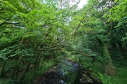
[Main photo: the River Walkham at Ward Bridge in the Walkham Valley] From high moor to the western border of Dartmoor National Park The River Walkham flows from remote, tussocky and boggy moorland on Dartmoor’s north moor through a heavily wooded valley to the western border of Dar...

Steps Bridge, Dunsford, Dartmoor National Park (approx. 9 miles away)
Built at the beginning of the 19th century, Steps Bridge spans the River Teign near the north eastern border of Dartmoor National Park. We've positioned Steps Bridge on Google maps so zoom in on the 'Satellite' setting to see its location. There's a car park just up the hill to the west of t...