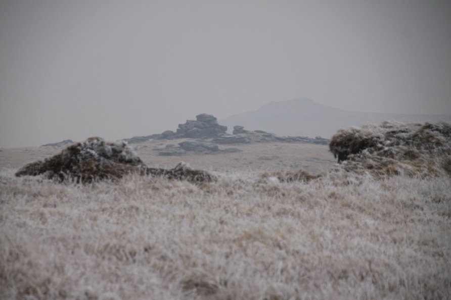
Fur Tor, Postbridge, Dartmoor National Park

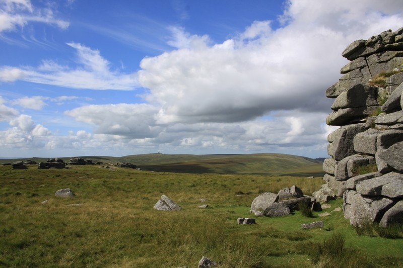
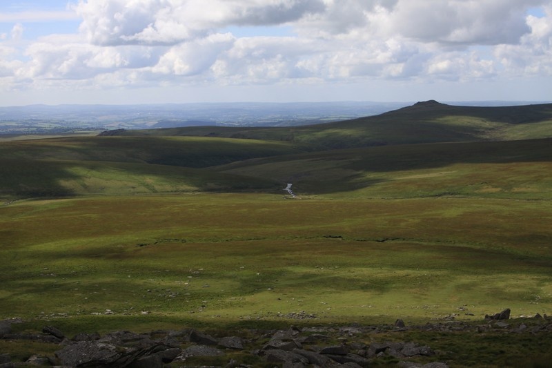
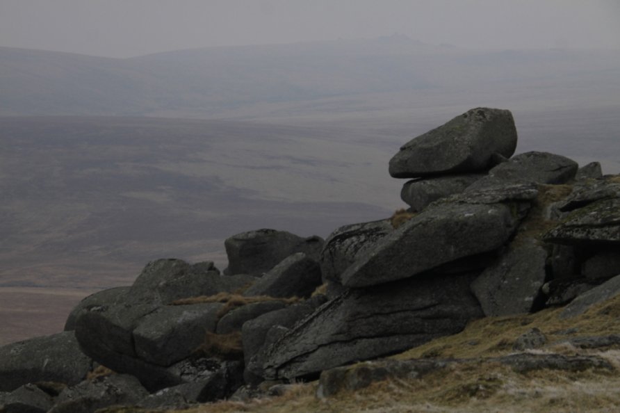
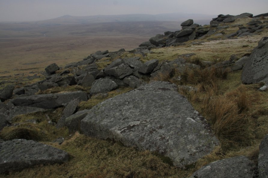
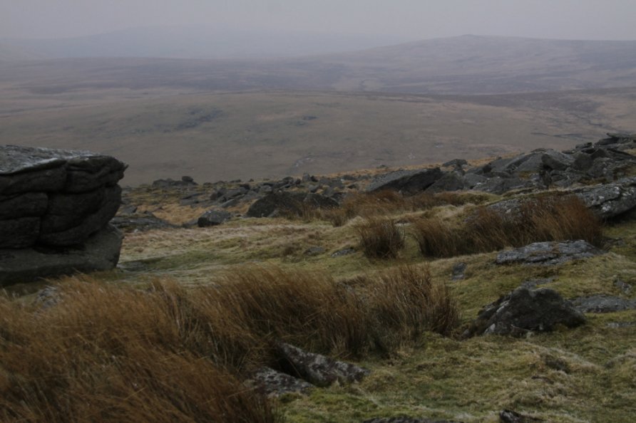
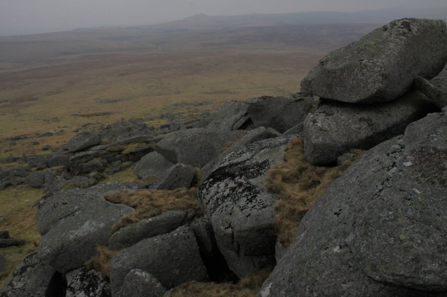
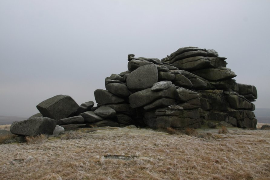
Said to be the most remote area within Dartmoor National Park and, as a consequence, southern England, Fur Tor is essential visiting for any Dartmoor lover or anyone with a passion for the outdoors. The views from Fur Tor are exceptional, perhaps among the finest in the Park. Stood on one of the tor's many granite outcrops, you have panoramic views of the highest ground within the Park.
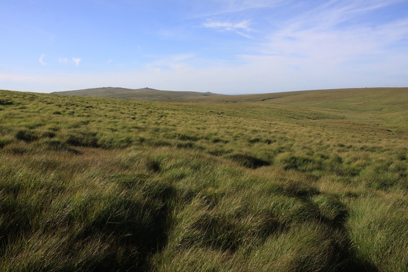
Yomp up to the more accessible summits of Yes Tor, High Willhays or Great Links Tor and you'll see a huge jumble of rocks rising from the heart of the north plateau. This is Fur Tor. Behind it is the dome of Cut Hill. In front, Fur Tor slopes down to where Amicombe Brook meets the River Tavy. When you're at Fur Tor, there are a number of outcrops and then a vast clitter field on the aforementioned slope. The place feels wild and remote.
Routes and directions to Fur Tor
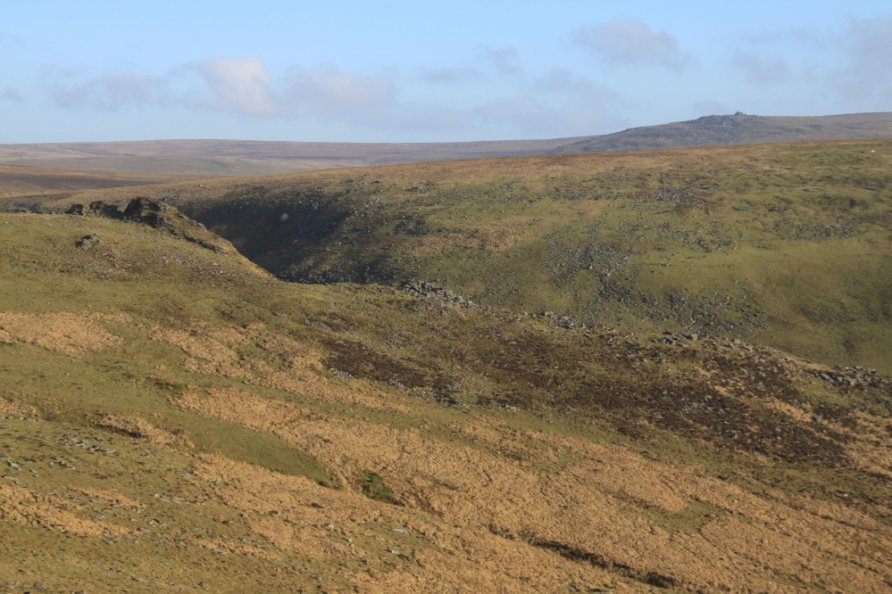
Given its location at the heart of the north plateau, you can walk in from all directions. Some routes are difficult. Even after a spell of dry weather, the ground for miles around Fur Tor is boggy and tussocky. In parts, the rough cut moorland shaped by the former peat industry makes the surface seem endlessly uneven. That said, despite this difficulty, in the scheme of things, walking to Fur Tor is relatively straightforward.
Easiest and recommended route to Fur Tor for the first time
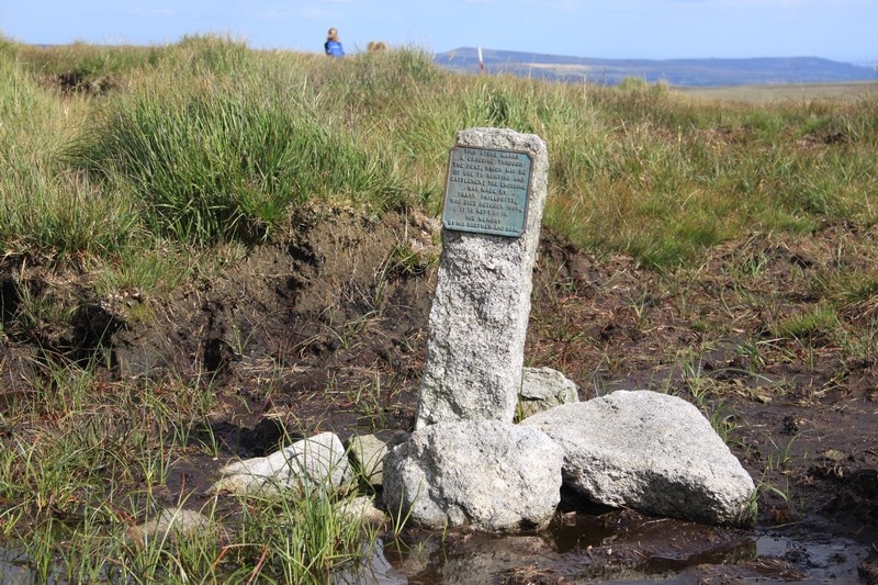
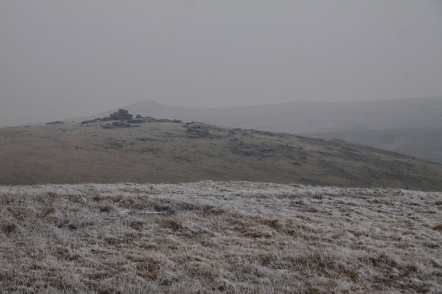
To visit for the first time, we'd suggest you follow the 'classic' route from the Postbridge National Park Visitor Centre up the East Dart River Valley to the foot of Cut Hill. It's then a gradual climb to the top of Cut Hill and then Fur Tor. Start at the car park in front of the visitor centre. Wander around the back of the building and walk through a gap in the hedge onto Drift Lane. Follow that past Roundy Park, cross the little stream and follow the left hand side of the wall all the way up to Broad Down. Stiles are situated along the wall towards the top of Broad Down. Ahead, below, is the East Dart River and then Sandy Hole Pass. Walk the left, or west, bank of the river past the East Dart River Waterfall and through Sandy Hole Pass to the foot of Cut Hill. The remains of the tin mining industry are all around. The dome of Cut Hill rises to the north west. You'll see the red and white striped firing poles demarcating the border of the Merrivale/Okehampton Firing Ranges. Follow the line of those poles and you come to Cut Hill Peat Pass and its memorial plaques. At the top of the pass, the mass of rocks that top Fur Tor are in front of you. Walk across the neck of moorland to get to the tor. Enjoy the experience. Retrace your steps.
Routes and directions to Fur Tor from the east
To walk in from the east, it's probably best to start from one of the car parking areas in Fernworthy Forest although you can begin at the Warren House Inn or Batworthy Corner. From any of these starting points, head for Sittaford Tor and then trend west to Statt's House. Continue west, avoiding Broad Marsh, and you'll come to the East Dart River. It's easy to cross this river this far upstream. Jump across Cut Lane Stream and yomp up to Cut Hill and across to Fur Tor.
Routes and directions to Fur Tor from the west
To walk in from the west, after a period of dry weather, start at the Lane End car park. Follow the leat into the stunning Tavy Cleave. Pass under the tors and walk the left, or north, bank of the River Tavy to the top of the cleave. Cross the stream and wander up past the army hut and down to Amicombe Brook. Ford the river. Don't go up to Dinger Pool as it's very boggy. Once you've crossed the brook, it's a climb up the clitter field to the top of Fur Tor. Alternatively from Lane End, cross the wooden bridge at Standon Steps and up through the prehistoric round houses to Standon Hill. Walk east across three streams and over boggy ground to Fur Tor. Last, you can park near Bagga Tor (not much space) and cross the high moorland from there. Again, it's boggy, difficult terrain and you'll have to cross the upper section of the River Tavy to get to Fur Tor. Crossing the river is a real problem when water levels are high so try the western approach after a spell of dry weather when water levels are low.
Routes and directions to Fur Tor from the north
Walking in from both the north and south is, in our opinion, unpleasant in all but dry weather. After a dry spell, it can be a magical experience. To walk in from the north, start from one of the parking areas on the army roads by Okehampton Camp. Follow the army road up to Okement Hill. Walk to Cranmere Pool via Hangingstone Hill or Ockerton Court. You then have to make your way across the rough cut moorland of Black Hill. With some luck, you might see a red grouse. It's a broad ridge of unforgiving walking to Cut Hill. Continue to Fur Tor. Alternatively, head for Black Ridge Peat Pass and follow the old North-South (track) marked on the Harvey British Mountain Map 'Dartmoor' map. This is a remote and tricky route however. Note that you can walk from the Dartmoor Inn up past Great Links Tor and across Amicombe Hill to Black Ridge Peat Pass. Again, only try this after a spell of dry weather.
Routes and directions to Fur Tor from the south
To walk in from the south, use the directions in our Cut Hill listing: 'After a spell of dry weather, you can wander across the moorland between the sources of the West Dart River, River Tavy and River Cowsic via Devil's Tor and Beardown Man Standing Stone. Even after a period of sunny weather, it's boggy and difficult walking. Start from the car parking areas at either Holming Beam and Two Bridges and head for Lydford Tor before yomping across moorland to Devil's Tor and Beardown Man Standing Stone.'
Other routes and directions to Fur Tor
Clearly, there are other routes and variations on the routes outlined above. For example, you can wander across the East River Dart from Whitehorse Hill to Black Hill from the north east or from Sandy Ford on the Lichway to the south west. After a spell of dry weather, you can't really go wrong. Distance and terrain are the barriers. We've walked all the above routes over the years and never experienced problems.
When is it best to walk to Fur Tor?
Last, the seasons. We love walking to Fur Tor in winter when the ground is frozen. Days are short so start early. After dry weather, the moorland dries out but still look out for boggy patches. After wet weather, we'd advise you to stick to the classic route. The moorland for miles around Fur Tor can get very boggy. Walking in these conditions is exhausting and potentially dangerous. Over the years we've been walking to Fur Tor, there have been extended dry periods in Spring and Summer. Take advantage of the conditions to explore these remote areas.
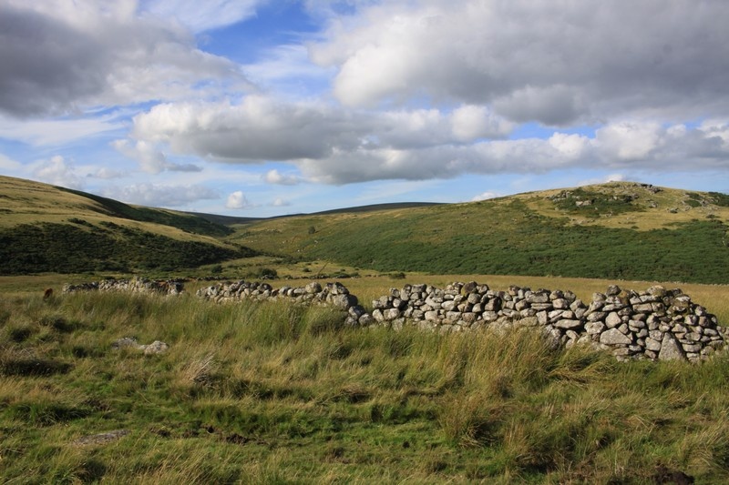
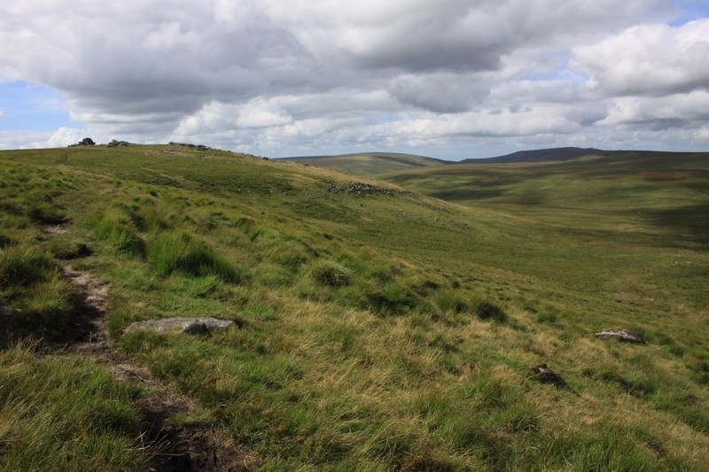
Photo Gallery