North-South (Track) Ancient Travel Route, Okehampton, Dartmoor National Park

This is one of the most difficult long distance routes we’ve walked in Dartmoor National Park. It’s marked on the Harvey British Mountain Map ‘Dartmoor’ map as an ancient travel route across Dartmoor. We’ve split it into two sections running north to south.
Section 1. North
Start at Okehampton. Follow the road that climbs to Okehampton Camp on the edge of the north moor. From there, take the army road that rises between Rowtor and West Mill Tor to Dinger Tor. Whilst this section is uphill, it’s easy walking on the army road. From Dinger Tor, it gets tricky.
Head south from Dinger Tor to Kneeset Nose. The ancient track swings around west of Kneeset Nose crossing the West Okement just north of Broad Amicombe Hole but when you’re there, you’ll see a ford and crossing area on the eastern side of Kneeset Nose. We normally use this.
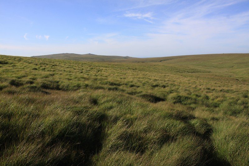
The next section follows the shape of the West Okement River upstream. It runs along the side of the moor past Jackman’s Bottom to avoid the low, boggy ground which can get very difficult to cross. The grass on the side of the moor here is very high and it’s very difficult walking so take care.
Note that there are no paths. This is remote moorland. Sometimes you can follow the tracks of local farmers’ quad bikes.
From Jackman’s Bottom, the route runs above the West Okement River to the start of Black Ridge Peat Pass. There’s a memorial stone. Follow the peat pass for about a kilometre south. It’s a weird, wonderful landscape but there are piles of white rocks to guide you to another memorial stone at the southern end of the pass. You’ll see Fur Tor, the most remote place in southern England, in front of you. Again, take care walking as you’re a long way from help.
From Black Ridge, the North-South Track runs south west to a dip between Little Kneeset and Little Kneeset Peat Pass. Cross Black Ridge Brook. On the ground, we tend to cross upstream below the peat pass which is a little east of the route on the Harvey map. You then drop down to the ford on Cut Combe Water at the foot of Fur Tor. Walking here is easy, the moorland grass short and the ground flat. Enjoy the remote location.
Having crossed the ford at Cut Combe Water, you’ll see granite posts and stones ahead of you on the lower flank of Cut Hill that guide you up over this vast dome of moorland. Follow the line of Cut Lane Stream and cross Cut Hill Stream. You’re in old mining territory and for the first time in hours, you’ll pick up a path to Broada Marsh Stream and Sandy Hole Pass. You’re back to easy walking.
Wander past East Dart River Waterfall and up over Broad Down. Use the stile to go over the farm wall and drop down to Drift Lane and Postbridge. You’ve crossed the north moor.
Section 2. South
From Postbridge, walk to Bellever. Take the forestry road through the forest to moorland near Laughter Hole Farm. You’ll see Laughter Tor on your right. Follow the path to Dunnabridge Pound.
The next part of the route runs across private land. As such, you have to divert east along the main road. Very shortly, you’ll see a path to your right that takes you down to Sherberton West Dart River Stepping Stones. Cross these, follow the east bank of the River Swincombe until you come to a very small set of stones below Sherberton. Cross the water and head for Hexworthy.
Note that the ancient track actually runs west of Sherberton and across Royal Hill to the eastern end of Foxtor Mires. We’d recommend avoiding this as it can be very difficult to ford the River Swincombe here. Instead, from Hexworthy, follow the path along Wheal Emma Leat to the eastern end of Foxtor Mires. This avoids the need to cross the Swincombe and you pick up the North-South Track by Headwater Ford. Keep high above the river and head for the ruins of Foxtor Farm. Drop down to Childe’s Tomb crossing the river as you go. Yomp up to Fox Tor. The next section is remote and boggy. It’s difficult walking so take care.
From Fox Tor, trend west of Foxtor Girt. Don’t drop down into it as it’s very boggy. Follow the ancient Black Lane Peat Pass to a broken post at its southern end. The North-South Track runs through some dangerous, boggy ground so keep east of Black Lane Mire.
When you’re there, you’ll follow wet tracks across the moor. Cross a little stream and you’ll pick up a path that runs through a remarkable mining landscape on its way to the River Erme.
Note that the longest stone row in the world starts/ends to you left on Green Hill.
Walk to Erme Pound. We usually skirt the area where Red Lake meets the River Erme. Instead, follow the path east to Red Lake Ford and loop around to Erme Pound. The route then runs along moorland just west of the railway trackbed. You cross Left Lake, walk below Three Barrows and above Piles Copse towards Sharp Tor and Piles Hill. Last, the North-South Track drops down to Harford Moor Gate. Wandering along the trackbed will save time.
To reiterate, this is an ancient route. Don’t expect a path or any signposts. The walk can be very difficult and it takes you across some of Dartmoor’s most remote and challenging terrain. If you want to walk north to south and are looking for something a little more simple, try the North to South Route In A Day.
Photo Gallery