Shilstone Tor, Cosdon Beacon and Cosdon (The Cemetery) Stone Row Circular Walk, Throwleigh, Dartmoor National Park

Start at Shilstone Tor by the village Throwleigh on the edge of the high north moor. We've positioned a marker on the accompanying Google map to locate this. There's limited parking by the tor. A road runs along the border of the moor and farmland. If you cannot park by Shilstone Tor, there are other small parking spots along the road.
Stand on Shilstone Tor and you'll see the huge dome of Cosdon Hill to the north west. This walk takes you to Cosdon Beacon at the top of the hill and then down to the remarkable triple stone row known locally as The Cemetery on Cosdon's eastern flank before returning across Throwleigh Common to Shilstone Tor.
The first part of the walk provides super views of the north east section of the National Park including the National Trust's Castle Drogo, Chagford and the high moors around Fernworthy Forest. Once you are at Cosdon Beacon, the north west of Dartmoor opens out. This is the highest ground in southern England at High Willhays and Yes Tor. The views are sublime. On a clear day, you can also look north to Exmoor National Park.
From Shilstone Tor, follow the wide grass track that trends north west. Soon, you'll come to a second grass track that takes you to the ford across Blackaton Brook. The ford is marked on the Ordnance Survey Explorer OL28 'Dartmoor' map. If the ford is deep, it's relatively easy to jump over the brook. We've never had problems crossing here over the years. Note that the very dangerous Raybarrow Pool is upstream. Avoid. From the ford, an obvious and worn path takes you over a second brook unmarked on that Ordnance Survey map and then up the side of Cosdon. You'll see Cosdon Beacon and a trig point in front of you. Again, the views from here are sublime.
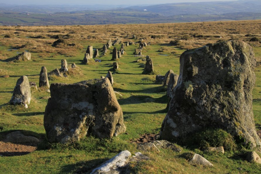
From the beacon, walk the grass track north east to the cairns marked on the Ordnance Survey map. From there, you drop down to the triple stone row. As you descend, the views with the stone row in the foreground and Castle Drogo behind at the mouth of the Teign Gorge are superb.
Once you've explored the triple stone row, follow the wide grass track south east to Shilstone Tor. You cross Blackaton Brook where it meets Cheriton Combe on the Ordnance Survey map. Note that the route across the last section of the walk is not clear. There are various pony tracks that run across the moorland. Don't expect a clear, defined path. That said, the terrain isn't too challenging. Avoid the boggy area just west of Blackaton Brook and Cheriton Combe. On the ground, you'll see patches of standing water and red grasses that signal boggy ground.
You'll come to the wide grass track that leads you back to Shilstone Tor where you started.
For the ground you cover and the points of interest and views you enjoy, it's a short walk taking about 2 hours to complete.
Photo Gallery