Lustleigh Cleave Circular Walk, Lustleigh, Dartmoor National Park

Tors/rocky outcrops, the beautiful River Bovey and ancient woodland
Along with the Teign Gorge Circular Walk and Dart Gorge Circular Walk, this is one of the finest walks in Dartmoor's many valleys, cleaves and gorges. You'll experience Dartmoor's famous tors/rocky outcrops, the beautiful River Bovey and ancient woodland. If possible, walk in spring when Lustleigh Cleave is greening or autumn when the colours turn.
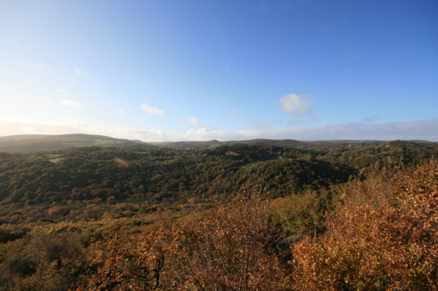
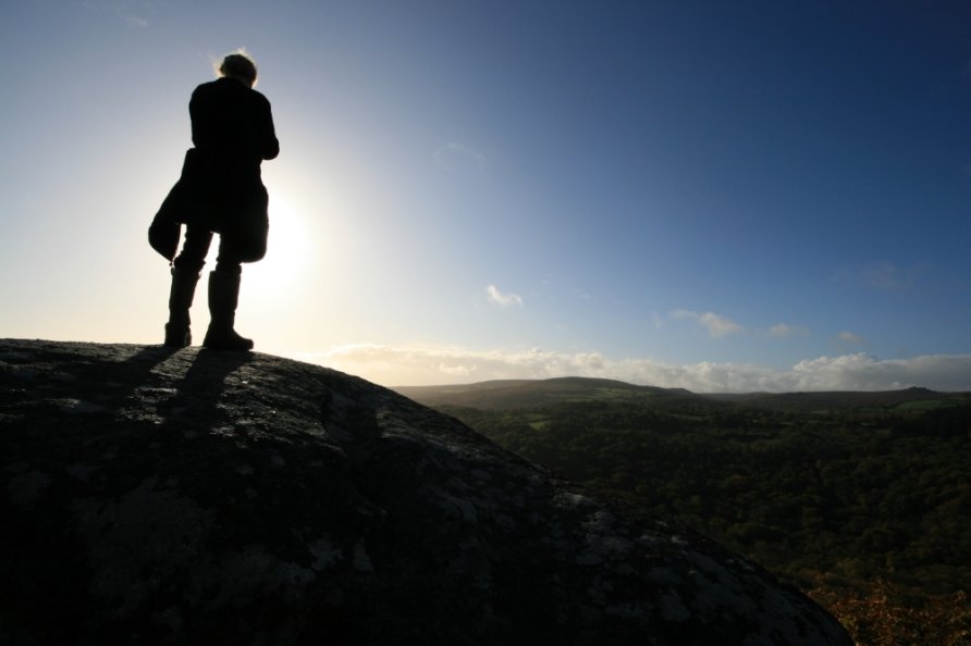
The views from the ridgeline of this walk over the eastern section of Dartmoor National Park are spectacular. The views from Hunter's Tor to the north moor are immense.
How far is it and how long will it take?
The walk is roughly 6 km/4 m in length.
The Ordnance Survey app states that this takes about 1.30 hrs. We tend to cover a Dartmoor mile in 30 mins so plan for 2 hrs to enjoy the views and take photos.
What's the walking like?
It's a mix of steep climbs and easy ridge walking. It's not difficult.
Is there a path?
Yes, you're following paths in Lustleigh Cleave.
Note that Lustleigh Cleave is criss-crossed with paths used by local walkers. We'd recommend sticking to the paths outlined on the Ordnance Survey app or Explorer OL28 'Dartmoor' map on your first walk in the cleave.
Is it well signposted?
Yes and no. There are signposts in Lustleigh Cleave but the area is heavily wooded so it's relatively easy to wander off the path.
We'd recommend referring to the Ordnance Survey app or Explorer OL28 'Dartmoor' map whilst reading this route description. Take a map and compass and check directions regularly.
Start at Hammerslake
Park in the lay-by at Hammerslake.
Hammerslake is marked on OS mapping on the eastern side of Lustleigh Cleave below Sharpitor. Note that the moorland lanes leading to Hammerslake are narrow and steep in places. Be patient.
The lay-by might be full if you're visiting in the holiday season or on a busy weekend. Park in Lustleigh and walk up to Hammerslake instead.
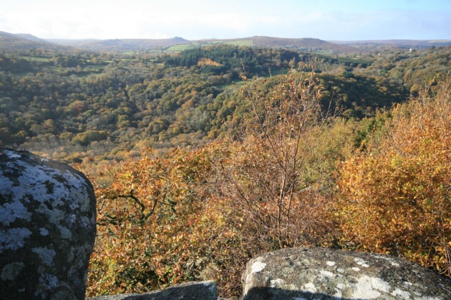
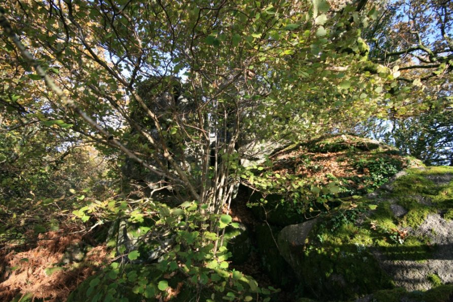
Spectacular rocky outcrops and the broad ridge running along the top of Lustleigh Cleave
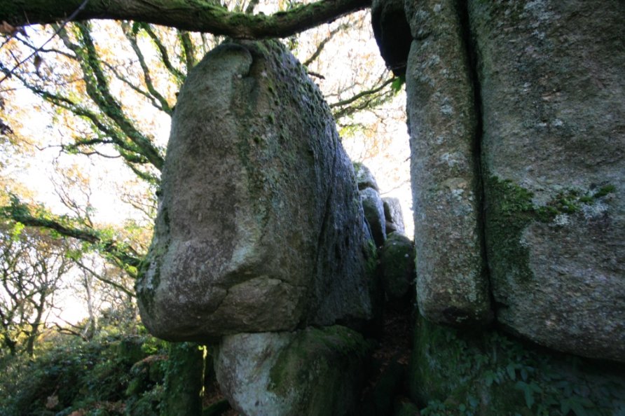
You'll see a sign on the left hand side of the road. Follow the narrow, sunken path into the woods. Head up past spectacular rocky outcrops and a cave to Sharpitor and the ridgeline. The woods thin out and views appear on your left. Walk the broad ridge at the top of Lustleigh Cleave to Harton Chest.
Harton Chest
Harton Chest is a rocky outcrop overlooking Lustleigh Cleave and the Bovey Valley Woodlands. If you have a head for heights, the views are sublime from the highest rock. Be careful as there are huge drops off the side of Harton Chest.
Hunter's Tor
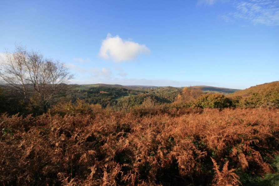
From Harton Chest, continue north west to Hunter's Tor. You leave woodland (see below for an alternative route) and cross open moorland. The views back down to the Bovey Valley Woodlands, and beyond to the sea, are massive. The pretty village Manaton and its church are to the south east. Haytor Rocks are visible to the south.
At Hunter's Tor, the north moor opens out. The huge dome of Cosdon Hill dominates the view to the high ground. The pretty village North Bovey and the luxury hotel Bovey Castle sit in countryside below. You'll also see the National Trust's Castle Drogo at the mouth of the Teign Gorge and Moretonhampstead in the Wray Valley.
Peck Farm and Foxworthy
Drop down to Peck Farm and then turn left to Foxworthy and the mouth of Lustleigh Cleave. The River Bovey passes under Foxworthy Bridge.
Lustleigh Cleave to Hammerslake
Follow the path along the north bank of the River Bovey. This climbs through Lustleigh Cleave. You'll pass under Sharpitor on your way to Hammerslake and your vehicle.
Alternative path down from Hunter's Tor
For a slightly shorter walk, there's a faint, unmarked path down to the River Bovey where the woodland ends north west of Harton Chest. Follow this steep path through Lustleigh Cleave towards the River Bovey. Turn left when you hit the main path to loop round under Sharpitor and back to Hammerslake (signposted) as described above.
Alternative starting points
Hammerslake is the best starting point but it's remote. For easier parking, you can also start from Manaton, the car parks at the eastern end of Trendlebere Down or the parking area at Drakeford Bridge.
There's a car park by the church in Manaton. Using OS maps, follow one of the many paths to one of the crossing points on the River Bovey. These are Foxworthy Bridge, Horsham Steps (boulder crossing only when river water levels are low) and Clam Bridge. Having crossed the river, connect with the loop described above.
There are lots of car parks at the eastern end of Trendlebere Down by the road between Pullbrook Wood and Yarner Wood. Walk the old road down to Hisley Bridge and then head up into Lustleigh Cleave to connect with the loop described above.
There's a car park at Drakeford Bridge. Walk either bank of the River Bovey to Hisley Bridge and then head up into Lustleigh Cleave to connect with the loop described above.
Photo Gallery