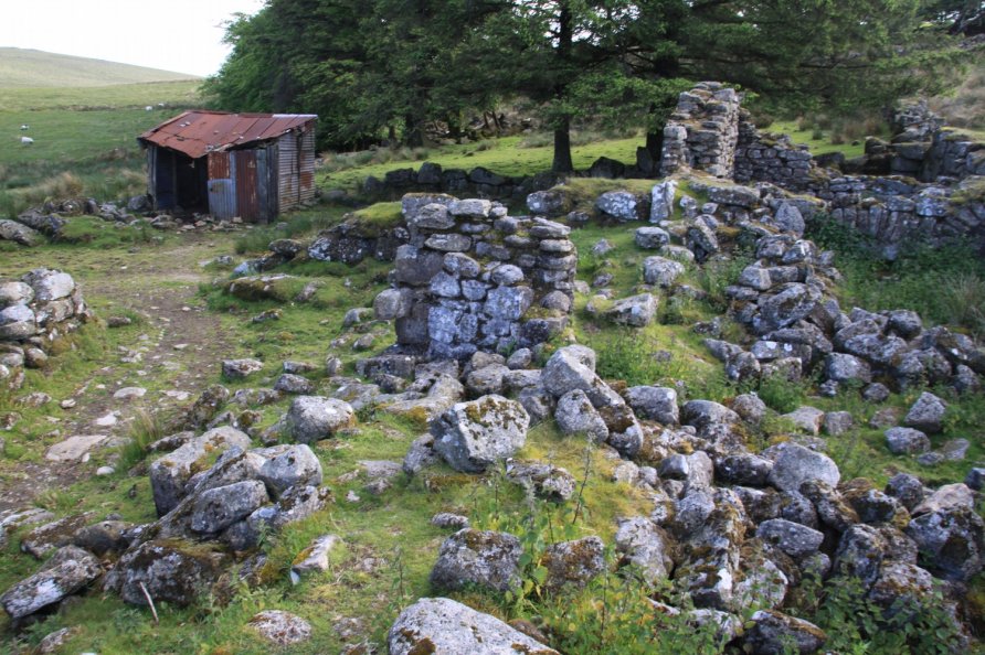
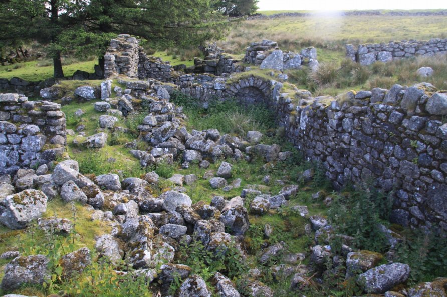
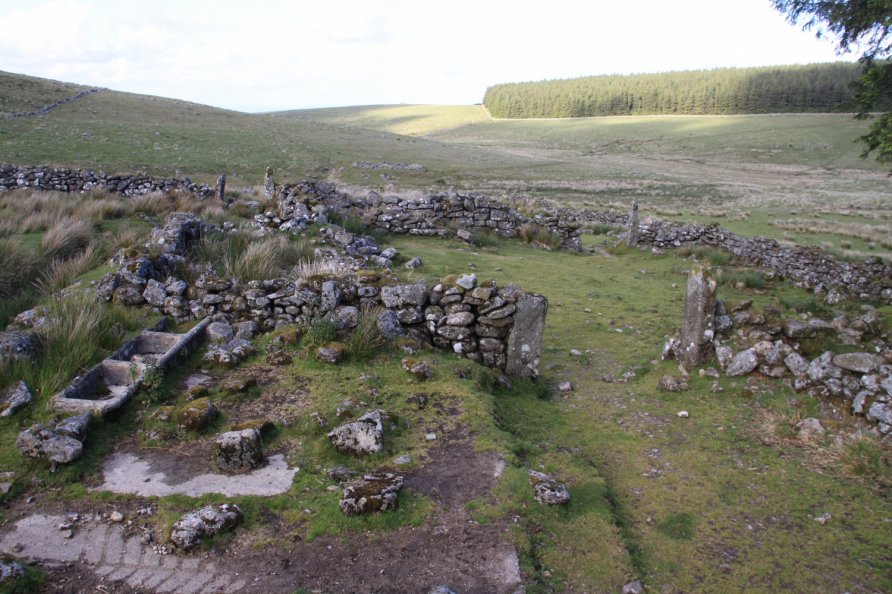
Teignhead Farm (Ruins), Chagford, Dartmoor National Park

Whilst chatting to a local farmer on Thornworthy Tor, we were told that two farms lay in ruins or were submerged by water in Fernworthy Forest and Fernworthy Reservoir. Another ruined farm lies just west of the forest near Sittaford Tor, Quintin's Man and the source of the North Teign River. This is called Teignhead Farm.
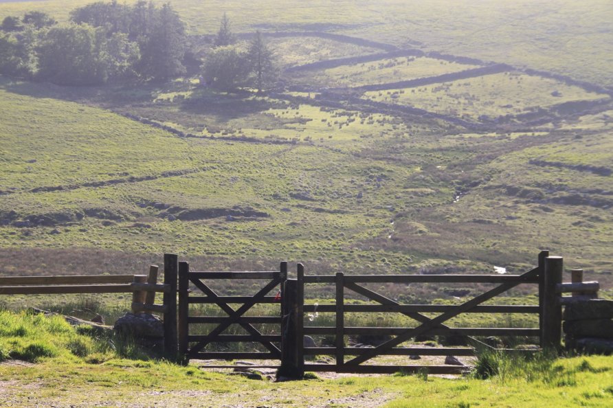
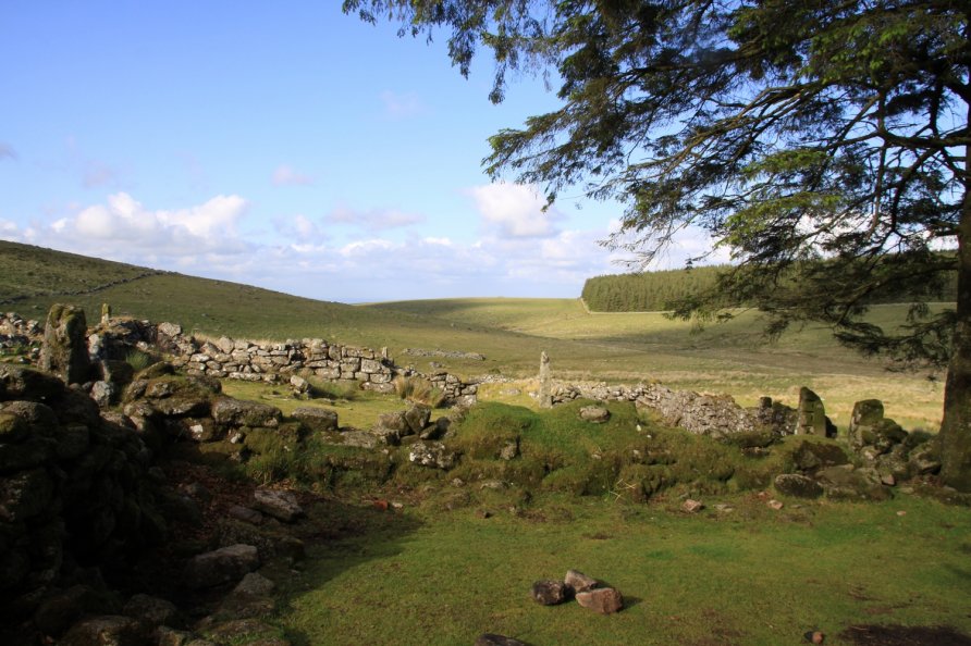
Whilst it's a lovely walk through a forest, over moor and across a fine clapper bridge to get to Teignhead Farm, we'd recommend visiting for its sense of isolation. Situated on the flank of Dartmoor's high north plateau, it can be both remarkably beautiful and bleak dependent on the weather. The ruin of Statt's House is reasonably close as are the army huts on summits including Quintin's Man.
The ruins of Teignhead Farm are situated close to the headwaters, or start, of the North Teign River and South Teign River on the edge of Dartmoor's north plateau. It's a remote place that's popular with wild campers.
If you look at the Ordnance Survey Explorer OL28 'Dartmoor' map, you'll see the North Teign Head by Quintin's Man just south of Whitehorse Hill. The water picks up speed and swings around a spur of land below Sittaford Tor and Sittaford Stone Circle before running between the ruins of Teignhead Farm and the western border of Fernworthy Forest. The old Sand Path Link climbs north west of the farm and skirts Teignhead Great Mire on its way to Whitehorse Hill. It's steep, difficult ground.
We've positioned Teignhead Farm on Google maps so zoom in on the 'Satellite' setting to see its location.
To visit, walk in from Batworthy Corner above Chagford, Fernworthy Forest or Postbridge. You wander over Shovel Down from Batworthy. Paths are marked on the Ordnance Survey Explorer OL28 'Dartmoor' map from the other starting points.
Photo Gallery