Shaptor Rock, Bovey Tracey, Dartmoor National Park

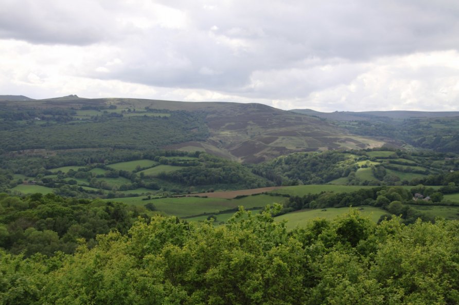
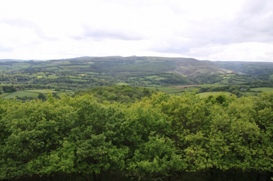
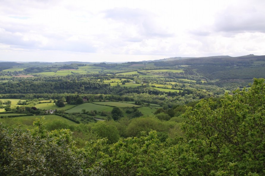
Shaptor Rock is well known in the Dartmoor climbing community. You'll often see people bouldering on its chunky rock face with padded mats on the woodland floor below. For walkers, the views from the top of Shaptor Rock are exceptional. To the west and north west are the National Park's high moors. To the south and south west are the rolling hills and towns of South Devon. In the foreground, all around, as you stand on the vast slab of moss covered rock that caps Shaptor Down, are twisted, gnarled, small oak trees covered in lichen that thrives in clean air. It's a fantastic place but it does take some effort to get there.
We've positioned Shaptor Rock on Google maps so zoom in on the 'Satellite' setting to see its location. To visit for the first time, it's probably best to follow the path that snakes through Shaptor Wood from Furzeleigh Plantation and Bearacleave Wood. If you're coming by car, there's a large parking area by Furzeleigh Cross. A little further down the skinny road that takes you to Bovey Tracey Hospital is another parking area on a bend in the road at the south east corner of Bearacleave Wood. There's room for two or three cars there.
From either car parking area, head for the ancient, sunken road that runs east/west between Furzeleigh Plantation/Bearacleave Wood and Shaptor Wood. On that ancient, sunken road is a gate with Woodland Trust signs. It's the beginning of the permissive path that is marked on the Ordnance Survey Explorer OL28 'Dartmoor' map. A very obvious path twists and climbs for a long way through the woods to the Shaptor Rock area. It's the sort of walk that gets the blood pumping. Along the way, you'll pass posts on top of which are memorial plaques.
Towards the top of Shaptor Wood, you come to a waymarker. Head east and you'll see the chunky rock face of Shaptor Rock. Walk past it and then loop up the steep woodland floor to the top. You'll know you're there because you'll be stood on a vast, moss covered slab of rock on the tree line. The views across the top of the trees are superb.
You can also walk in from the north west. There's limited parking off the narrow road that rises steeply from Slade Cross to the reservoirs above Bovey Tracey. Wander back down the road and you'll see a waymarker pointing you in the direction of Shaptor Wood. You'll pass a cluster of big houses and by a tall deer fence in to the wood. This route is marked on the Ordnance Survey Explorer OL28 'Dartmoor' map. It's quicker than the Furzeleigh Plantation/Bearacleave Wood walk but parking can be a problem.
There's another path from the south east that runs past Higher Bowden and Shaptor Farm in to the wood. Again, refer to the Ordnance Survey Explorer OL28 'Dartmoor' map for detail.
If you don't mind a longer walk, yomp up from Lustleigh or across from the aforementioned reservoirs.
Photo Gallery